Belfield geodata
Belfield (North Dakota) is a populated place; located in United States in America/Denver (GMT-6) time zone. With population of 1,055 people, there are 15926 cities with bigger population in this country. Compared to other cities in United States, 96.5% of cities are located further ↓South; 82.3% of cities are located further →East and 91.9% of cities have lower elevation than Belfield. Note1


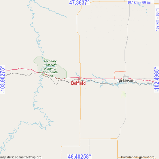
Belfield GPS coordinates[2]
46° 53' 7.044" North, 103° 11' 58.632" West
| Map corner | latitude | longitude |
|---|---|---|
| Upper-left | 47.3637°, | -103.90275° |
| Center: | 46.88529°, | -103.19962° |
| Lower-right: | 46.40258°, | -102.4965° |
| Map W x H: | 106.9×106.9 km | = 66.4×66.4mi |
| max Lat: | 71.29058° ⇑3.5% North |
| Belfield: | 46.88529° |
| min Lat: | ⇓96.5% South 19.06759° |
| min Long | Belfield | max Long |
| -171.73463° | -103.19962° | -66.98998° |
| W 17.7%⇐ | ⇒82.3% E |
Elevation
Elevation of Belfield is 787 m = 2582 ft, and this is 492.2 m = 1615 ft above average elevation for this country.
| Max E: |
3189 m = 10463 ft | 8.1% |
| Belfield | 787 m 2582 ft | |
| Avg. | 294.8 m = 967 ft | |
Min E: |
-60 m = -197 ft | 91.9% |
See also: United States elevation on elevation.city.
Geographical zone
Belfield is located in North temperate zone (between Tropic of Cancer and the Arctic Circle). Distance of this North polar circle is 2188 km =1359.6 mi to North.| Distance of | km | miles | from Belfield |
|---|---|---|---|
| North Pole | 4793.9 | 2978.8 | to North |
| Arctic Circle | 2188 | 1359.6 | to North |
| Tropic Cancer | 2607.2 | 1620 | to South |
| Equator | 5213.2 | 3239.3 | to South |


Nearby cities:
15 places around Belfield: (largest is in red/bold)
• Amidon
45.8 km =28.5 mi,  191°
191°
• Baker
100.9 km =62.7 mi,  235°
235°
• Beach
61.2 km =38 mi,  273°
273°
• Bowman
79.5 km =49.4 mi, 190°
• Dickinson
31.2 km =19.4 mi,  91°
91°
• Hebron
87.7 km =54.5 mi, 88°
• Killdeer
63.8 km =39.6 mi,  31°
31°
• Mandaree
101.8 km =63.3 mi,  22°
22°
• Manning
50.3 km =31.3 mi,  40°
40°
• Medora
24.9 km =15.5 mi,  277°
277°
• Mott
87.7 km =54.5 mi,  130°
130°
• New England
46 km =28.6 mi,  146°
146°
• Richardton
67.2 km =41.8 mi, 90°
• Watford City
102.1 km =63.4 mi,  356°
356°
• Wibaux
75.9 km =47.2 mi, 278°
Sources, notices
• [Note1] Compared only with cities in United States existing in our database
• [Src1] Map data: © OpenStreetMap contributors (CC-BY-SA)
• [Src2] Other city data from geonames.org with taken over terms of usage.
• [Src3] Geographical zone / Annual Mean Temperature by Robert A. Rohde @ Wikipedia
