Mandaree geodata
Mandaree (North Dakota) is a populated place; located in United States in America/Chicago (GMT-5) time zone. With population of 596 people, there are 19749 cities with bigger population in this country. Compared to other cities in United States, 98.1% of cities are located further ↓South; 82.1% of cities are located further →East and 90.5% of cities have lower elevation than Mandaree. Note1
Administrative division(s):
- Level 1: North Dakota
- Level 2: McKenzie County
- Level 3: Unorganized Territory of Fort Berthold


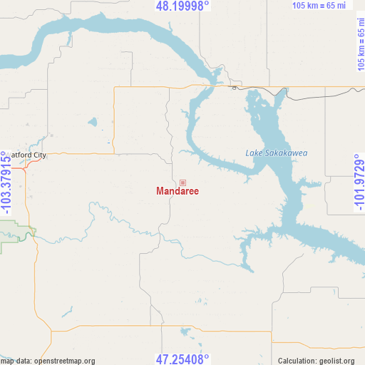
Mandaree GPS coordinates[2]
47° 43' 45.048" North, 102° 40' 33.672" West
| Map corner | latitude | longitude |
|---|---|---|
| Upper-left | 48.19998°, | -103.37915° |
| Center: | 47.72918°, | -102.67602° |
| Lower-right: | 47.25408°, | -101.9729° |
| Map W x H: | 105.2×105.2 km | = 65.4×65.4mi |
| max Lat: | 71.29058° ⇑1.9% North |
| Mandaree: | 47.72918° |
| min Lat: | ⇓98.1% South 19.06759° |
| min Long | Mandaree | max Long |
| -171.73463° | -102.67602° | -66.98998° |
| W 17.9%⇐ | ⇒82.1% E |
Elevation
Elevation of Mandaree is 664 m = 2178 ft, and this is 369.2 m = 1211 ft above average elevation for this country.
| Max E: |
3189 m = 10463 ft | 9.5% |
| Mandaree | 664 m 2178 ft | |
| Avg. | 294.8 m = 967 ft | |
Min E: |
-60 m = -197 ft | 90.5% |
See also: United States elevation on elevation.city.
Geographical zone
Mandaree is located in North temperate zone (between Tropic of Cancer and the Arctic Circle). Distance of this North polar circle is 2094.2 km =1301.3 mi to North.| Distance of | km | miles | from Mandaree |
|---|---|---|---|
| North Pole | 4700.1 | 2920.5 | to North |
| Arctic Circle | 2094.2 | 1301.3 | to North |
| Tropic Cancer | 2701.1 | 1678.4 | to South |
| Equator | 5307 | 3297.6 | to South |


Nearby cities:
15 places around Mandaree: (largest is in red/bold)
• Berthold
95.3 km =59.2 mi,  47°
47°
• Beulah
85.1 km =52.9 mi,  127°
127°
• Dickinson
94.9 km =59 mi,  185°
185°
• Four Bears Village
29.1 km =18.1 mi,  14°
14°
• Garrison
94.7 km =58.8 mi,  95°
95°
• Hazen
92.7 km =57.6 mi,  121°
121°
• Killdeer
40.1 km =24.9 mi, 188°
• Manning
56 km =34.8 mi, 187°
• New Town
31.2 km =19.4 mi,  26°
26°
• Parshall
47.5 km =29.5 mi,  58°
58°
• Ray
77.5 km =48.2 mi,  332°
332°
• Stanley
68.7 km =42.7 mi,  17°
17°
• Tioga
76.8 km =47.7 mi,  345°
345°
• Watford City
46.1 km =28.6 mi,  280°
280°
• Williston
84.1 km =52.3 mi,  303°
303°
Sources, notices
• [Note1] Compared only with cities in United States existing in our database
• [Src1] Map data: © OpenStreetMap contributors (CC-BY-SA)
• [Src2] Other city data from geonames.org with taken over terms of usage.
• [Src3] Geographical zone / Annual Mean Temperature by Robert A. Rohde @ Wikipedia
