Douglas geodata
Douglas (Wyoming) is a seat of a second-order administrative division; located in United States in America/Denver (GMT-6) time zone. With population of 6,531 people, there are 6092 cities with bigger population in this country. Compared to other cities in United States, 81.6% of cities are located further ↓South; 83.6% of cities are located further →East and 96.5% of cities have lower elevation than Douglas. Note1


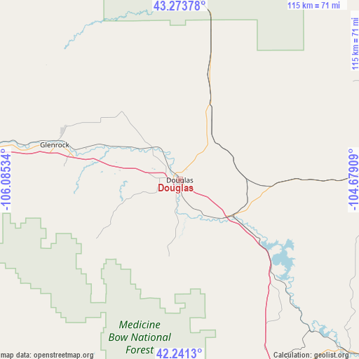
Douglas GPS coordinates[2]
42° 45' 34.884" North, 105° 22' 55.956" West
| Map corner | latitude | longitude |
|---|---|---|
| Upper-left | 43.27378°, | -106.08534° |
| Center: | 42.75969°, | -105.38221° |
| Lower-right: | 42.2413°, | -104.67909° |
| Map W x H: | 114.8×114.8 km | = 71.3×71.3mi |
| max Lat: | 71.29058° ⇑18.4% North |
| Douglas: | 42.75969° |
| min Lat: | ⇓81.6% South 19.06759° |
| min Long | Douglas | max Long |
| -171.73463° | -105.38221° | -66.98998° |
| W 16.4%⇐ | ⇒83.6% E |
Elevation
Elevation of Douglas is 1474 m = 4836 ft, and this is 1179.2 m = 3869 ft above average elevation for this country.
| Max E: |
3189 m = 10463 ft | 3.5% |
| Douglas | 1474 m 4836 ft | |
| Avg. | 294.8 m = 967 ft | |
Min E: |
-60 m = -197 ft | 96.5% |
See also: United States elevation on elevation.city.
Geographical zone
Douglas is located in North temperate zone (between Tropic of Cancer and the Arctic Circle). Distance of this Northern Tropic circle is 2148.5 km =1335 mi to South.| Distance of | km | miles | from Douglas |
|---|---|---|---|
| North Pole | 5252.6 | 3263.8 | to North |
| Arctic Circle | 2646.7 | 1644.6 | to North |
| Tropic Cancer | 2148.5 | 1335 | to South |
| Equator | 4754.4 | 2954.2 | to South |


Nearby cities:
15 places around Douglas: (largest is in red/bold)
• Bar Nunn
80.2 km =49.8 mi,  282°
282°
• Casper
76.9 km =47.8 mi, 278°
• Edgemont
140 km =87 mi,  64°
64°
• Evansville
73.1 km =45.4 mi, 278°
• Glenrock
41.5 km =25.8 mi,  285°
285°
• Guernsey
75.7 km =47 mi,  136°
136°
• Hanna
138.5 km =86.1 mi,  224°
224°
• Harrison
122.7 km =76.2 mi,  93°
93°
• Hartrandt
80 km =49.7 mi, 280°
• Lusk
75.9 km =47.2 mi, 89°
• Mills
80.8 km =50.2 mi, 276°
• Torrington
125.2 km =77.8 mi,  128°
128°
• Vista West
86.7 km =53.9 mi, 277°
• Wheatland
86 km =53.4 mi,  155°
155°
• Wright
110.6 km =68.7 mi,  355°
355°
Sources, notices
• [Note1] Compared only with cities in United States existing in our database
• [Src1] Map data: © OpenStreetMap contributors (CC-BY-SA)
• [Src2] Other city data from geonames.org with taken over terms of usage.
• [Src3] Geographical zone / Annual Mean Temperature by Robert A. Rohde @ Wikipedia
