View Park-Windsor Hills geodata
View Park-Windsor Hills (California) is a section of populated place; located in United States in America/Los_Angeles (GMT-7) time zone. With population of 11,075 people, there are 4160 cities with bigger population in this country. Compared to other cities in United States, 80.3% of cities are located further ↑North; 91.4% of cities are located further →East and 69.1% of cities have higher elevation than View Park-Windsor Hills. Note1
Current local time in View Park-Windsor Hills:
09:50 PM, TuesdayDifference from your time zone: hours


View Park-Windsor Hills GPS coordinates[2]
33° 59' 43.836" North, 118° 20' 54.06" West
| Map corner | latitude | longitude |
|---|---|---|
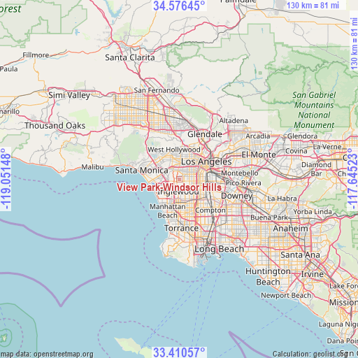
| Upper-left | 34.57645°, | -119.05148° |
| Center: | 33.99551°, | -118.34835° |
| Lower-right: | 33.41057°, | -117.64523° |
| Map W x H: | 129.6×129.6 km | = 80.5×80.5mi |
| max Lat: | 71.29058° ⇑80.3% North |
| View Park-Windsor Hills: | 33.99551° |
| min Lat: | ⇓19.7% South 19.06759° |
| min Long | View Park-Winds | max Long |
| -171.73463° | -118.34835° | -66.98998° |
| W 8.6%⇐ | ⇒91.4% E |
Elevation
Elevation of View Park-Windsor Hills is 106 m = 348 ft, and this is 188.8 m = 619 ft below average elevation for this country.
| Max E: |
3189 m = 10463 ft | 69.1% |
| Avg. | 294.8 m = 967 ft | |
| View Park-Windsor Hills | 106 m = 348 ft | |
Min E: |
-60 m = -197 ft | 30.9% |
See also: United States elevation on elevation.city.
Geographical zone
View Park-Windsor Hills is located in North temperate zone (between Tropic of Cancer and the Arctic Circle). Distance of this Northern Tropic circle is 1174 km =729.5 mi to South.| Distance of | km | miles | from View Park-Windsor Hills |
|---|---|---|---|
| North Pole | 6227.1 | 3869.3 | to North |
| Arctic Circle | 3621.2 | 2250.1 | to North |
| Tropic Cancer | 1174 | 729.5 | to South |
| Equator | 3779.9 | 2348.7 | to South |


Nearby cities:
15 places around View Park-Windsor Hills: (largest is in red/bold)
• Beverly Hills
9.9 km =6.2 mi,  331°
331°
• Century City
9.3 km =5.8 mi,  316°
316°
• Culver City
5.3 km =3.3 mi,  302°
302°
• Del Aire
9 km =5.6 mi,  192°
192°
• Florence-Graham
10.1 km =6.3 mi,  107°
107°
• Hawthorne
8.8 km =5.5 mi,  182°
182°
• Inglewood
3.8 km =2.4 mi, 186°
• Koreatown
8.2 km =5.1 mi,  32°
32°
• Ladera Heights
2.5 km =1.6 mi,  266°
266°
• Lennox
6.4 km =4 mi, 183°
• Marina del Rey
9.7 km =6 mi,  259°
259°
• Venice
10.3 km =6.4 mi, 267°
• West Athens
9 km =5.6 mi,  152°
152°
• Westmont
7.4 km =4.6 mi,  144°
144°
• Westwood
10.1 km =6.3 mi,  311°
311°
Sources, notices
• [Note1] Compared only with cities in United States existing in our database
• [Src1] Map data: © OpenStreetMap contributors (CC-BY-SA)
• [Src2] Other city data from geonames.org with taken over terms of usage.
• [Src3] Geographical zone / Annual Mean Temperature by Robert A. Rohde @ Wikipedia
