Sutton-Alpine geodata
Sutton-Alpine (Alaska) is a populated place; located in United States in America/Anchorage (GMT-8) time zone. With population of 1,447 people, there are 13891 cities with bigger population in this country. Compared to other cities in United States, 99.8% of cities are located further ↓South; 99% of cities are located further →East and 92.5% of cities have lower elevation than Sutton-Alpine. Note1


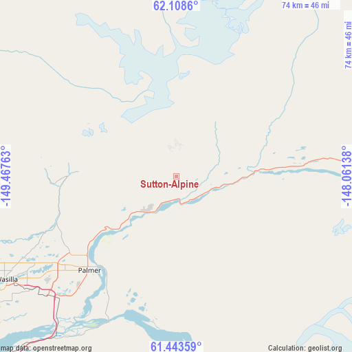
Sutton-Alpine GPS coordinates[2]
61° 46' 40.404" North, 148° 45' 52.2" West
| Map corner | latitude | longitude |
|---|---|---|
| Upper-left | 62.1086°, | -149.46763° |
| Center: | 61.77789°, | -148.7645° |
| Lower-right: | 61.44359°, | -148.06138° |
| Map W x H: | 73.9×73.9 km | = 45.9×45.9mi |
| max Lat: | 71.29058° ⇑0.2% North |
| Sutton-Alpine: | 61.77789° |
| min Lat: | ⇓99.8% South 19.06759° |
| min Long | Sutton-Alpine | max Long |
| -171.73463° | -148.7645° | -66.98998° |
| W 1%⇐ | ⇒99% E |
Elevation
Elevation of Sutton-Alpine is 861 m = 2825 ft, and this is 566.2 m = 1858 ft above average elevation for this country.
| Max E: |
3189 m = 10463 ft | 7.5% |
| Sutton-Alpine | 861 m 2825 ft | |
| Avg. | 294.8 m = 967 ft | |
Min E: |
-60 m = -197 ft | 92.5% |
See also: United States elevation on elevation.city.
Geographical zone
Sutton-Alpine is located in North temperate zone (between Tropic of Cancer and the Arctic Circle). Distance of this North polar circle is 532.1 km =330.6 mi to North.| Distance of | km | miles | from Sutton-Alpine |
|---|---|---|---|
| North Pole | 3138 | 1949.9 | to North |
| Arctic Circle | 532.1 | 330.6 | to North |
| Tropic Cancer | 4263.1 | 2649 | to South |
| Equator | 6869.1 | 4268.3 | to South |


Nearby cities:
15 places around Sutton-Alpine: (largest is in red/bold)
• Buffalo Soapstone
18.9 km =11.7 mi,  248°
248°
• Butte
29.8 km =18.5 mi,  208°
208°
• Eagle River
66.2 km =41.1 mi,  219°
219°
• Farm Loop
25.2 km =15.7 mi,  232°
232°
• Fishhook
25.1 km =15.6 mi,  261°
261°
• Gateway
33.9 km =21.1 mi, 227°
• Houston
57.9 km =36 mi, 253°
• Knik River
36.2 km =22.5 mi,  192°
192°
• Knik-Fairview
53.1 km =33 mi,  236°
236°
• Lakes
34.4 km =21.4 mi, 236°
• Lazy Mountain
19.4 km =12.1 mi, 209°
• Meadow Lakes
47.3 km =29.4 mi, 248°
• Palmer
27.1 km =16.8 mi, 222°
• Tanaina
38.8 km =24.1 mi, 244°
• Wasilla
41.9 km =26 mi, 238°
Sources, notices
• [Note1] Compared only with cities in United States existing in our database
• [Src1] Map data: © OpenStreetMap contributors (CC-BY-SA)
• [Src2] Other city data from geonames.org with taken over terms of usage.
• [Src3] Geographical zone / Annual Mean Temperature by Robert A. Rohde @ Wikipedia
