Alto Barinas geodata
Alto Barinas (Barinas) is a populated place; located in Venezuela in America/Caracas (GMT-4) time zone. With population of 284,289 people, there are 14 cities with bigger population in this country. Compared to other cities in Venezuela, 72.5% of cities are located further ↑North; 68.2% of cities are located further →East and 53.7% of cities have lower elevation than Alto Barinas. Note1


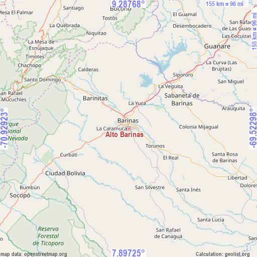
Alto Barinas GPS coordinates[2]
8° 35' 35.16" North, 70° 13' 33.96" West
| Map corner | latitude | longitude |
|---|---|---|
| Upper-left | 9.28768°, | -70.92923° |
| Center: | 8.5931°, | -70.2261° |
| Lower-right: | 7.89725°, | -69.52298° |
| Map W x H: | 154.6×154.6 km | = 96.1×96.1mi |
| max Lat: | 11.94788° ⇑72.5% North |
| Alto Barinas: | 8.5931° |
| min Lat: | ⇓27.5% South 1.92027° |
| min Long | Alto Barinas | max Long |
| -72.55212° | -70.2261° | -60.99778° |
| W 31.8%⇐ | ⇒68.2% E |
Elevation
Elevation of Alto Barinas is 194 m = 636 ft, and this is 186.6 m = 612 ft below average elevation for this country.
| Max E: |
2986 m = 9797 ft | 46.3% |
| Avg. | 380.6 m = 1249 ft | |
| Alto Barinas | 194 m = 636 ft | |
Min E: |
-4 m = -13 ft | 53.7% |
See also: Alto Barinas elevation on elevation.city.
Geographical zone
Alto Barinas is located in North Torrid zone (between Equator and Tropic of Cancer). Distance of Equator is 955.5 km =593.7 mi to South.| Distance of | km | miles | from Alto Barinas |
|---|---|---|---|
| North Pole | 9051.6 | 5624.4 | to North |
| Arctic Circle | 6445.7 | 4005.2 | to North |
| Tropic Cancer | 1650.5 | 1025.6 | to North |
| Equator | 955.5 | 593.7 | to South |


Nearby cities:
15 places around Alto Barinas: (largest is in red/bold)
• Barinas
3.9 km =2.4 mi,  31°
31°
• Barinitas
27.7 km =17.2 mi,  312°
312°
• Barrancas
23.4 km =14.5 mi, 32°
• Caramuca
10.4 km =6.5 mi,  272°
272°
• El Corozo
14.8 km =9.2 mi,  258°
258°
• El Real
30.8 km =19.1 mi,  124°
124°
• La Mula
16.6 km =10.3 mi, 261°
• La Yuca
16.1 km =10 mi,  18°
18°
• Los Guasimitos
8 km =5 mi,  355°
355°
• Obispos
13.4 km =8.3 mi,  83°
83°
• Quebrada Seca
15.7 km =9.8 mi,  319°
319°
• Sabaneta
36.7 km =22.8 mi,  61°
61°
• San Silvestre
37.5 km =23.3 mi,  160°
160°
• Torunos
19.1 km =11.9 mi, 122°
• Veguitas
36 km =22.4 mi,  44°
44°
Sources, notices
• [Note1] Compared only with cities in Venezuela existing in our database
• [Src1] Map data: © OpenStreetMap contributors (CC-BY-SA)
• [Src2] Other city data from geonames.org with taken over terms of usage.
• [Src3] Geographical zone / Annual Mean Temperature by Robert A. Rohde @ Wikipedia
