Carvajal geodata
Carvajal (Trujillo) is a seat of a second-order administrative division; located in Venezuela in America/Caracas (GMT-4) time zone. In our database, there are 108 cities with bigger population. Compared to other cities in Venezuela, 57.3% of cities are located further ↑North; 73.8% of cities are located further →East and 82.4% of cities have lower elevation than Carvajal. Note1


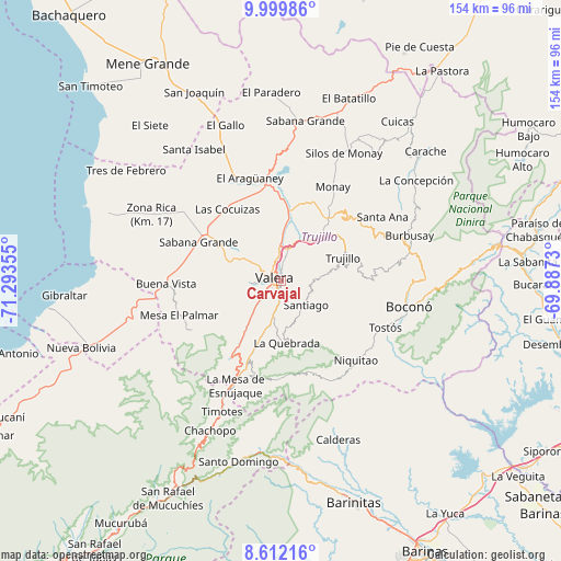
Carvajal GPS coordinates[2]
9° 18' 24.12" North, 70° 35' 25.512" West
| Map corner | latitude | longitude |
|---|---|---|
| Upper-left | 9.99986°, | -71.29355° |
| Center: | 9.3067°, | -70.59042° |
| Lower-right: | 8.61216°, | -69.8873° |
| Map W x H: | 154.3×154.3 km | = 95.9×95.9mi |
| max Lat: | 11.94788° ⇑57.3% North |
| Carvajal: | 9.3067° |
| min Lat: | ⇓42.7% South 1.92027° |
| min Long | Carvajal | max Long |
| -72.55212° | -70.59042° | -60.99778° |
| W 26.2%⇐ | ⇒73.8% E |
Elevation
Elevation of Carvajal is 799 m = 2621 ft, and this is 418.4 m = 1373 ft above average elevation for this country.
| Max E: |
2986 m = 9797 ft | 17.6% |
| Carvajal | 799 m 2621 ft | |
| Avg. | 380.6 m = 1249 ft | |
Min E: |
-4 m = -13 ft | 82.4% |
See also: Venezuela elevation on elevation.city.
Geographical zone
Carvajal is located in North Torrid zone (between Equator and Tropic of Cancer). Distance of Equator is 1034.8 km =643 mi to South.| Distance of | km | miles | from Carvajal |
|---|---|---|---|
| North Pole | 8972.3 | 5575.1 | to North |
| Arctic Circle | 6366.4 | 3955.9 | to North |
| Tropic Cancer | 1571.1 | 976.2 | to North |
| Equator | 1034.8 | 643 | to South |


Nearby cities:
15 places around Carvajal: (largest is in red/bold)
• Arapuey
40.1 km =24.9 mi,  262°
262°
• Betijoque
17.7 km =11 mi,  297°
297°
• Boconó
37.7 km =23.4 mi,  98°
98°
• El Dividive
24.5 km =15.2 mi,  319°
319°
• Escuque
9 km =5.6 mi, 263°
• La Quebrada
16.9 km =10.5 mi,  175°
175°
• Monte Carmelo
27.7 km =17.2 mi,  241°
241°
• Motatán
9.5 km =5.9 mi,  359°
359°
• Pampanito
15.1 km =9.4 mi,  40°
40°
• Pampán
19.9 km =12.4 mi, 39°
• Sabana Grande
25.1 km =15.6 mi,  294°
294°
• Sabana de Mendoza
24.8 km =15.4 mi,  305°
305°
• Timotes
39.6 km =24.6 mi,  204°
204°
• Trujillo
18.1 km =11.2 mi,  68°
68°
• Valera
1.9 km =1.2 mi, 310°
Sources, notices
• [Note1] Compared only with cities in Venezuela existing in our database
• [Src1] Map data: © OpenStreetMap contributors (CC-BY-SA)
• [Src2] Other city data from geonames.org with taken over terms of usage.
• [Src3] Geographical zone / Annual Mean Temperature by Robert A. Rohde @ Wikipedia
