Motatán geodata
Motatán (Trujillo) is a seat of a second-order administrative division; located in Venezuela in America/Caracas (GMT-4) time zone. In our database, there are 108 cities with bigger population. Compared to other cities in Venezuela, 54.5% of cities are located further ↑North; 74% of cities are located further →East and 63.4% of cities have lower elevation than Motatán. Note1


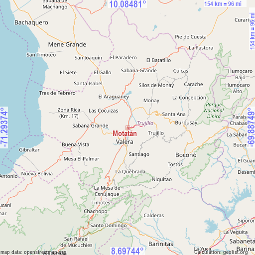
Motatán GPS coordinates[2]
9° 23' 30.552" North, 70° 35' 26.196" West
| Map corner | latitude | longitude |
|---|---|---|
| Upper-left | 10.08481°, | -71.29374° |
| Center: | 9.39182°, | -70.59061° |
| Lower-right: | 8.69744°, | -69.88749° |
| Map W x H: | 154.3×154.3 km | = 95.9×95.9mi |
| max Lat: | 11.94788° ⇑54.5% North |
| Motatán: | 9.39182° |
| min Lat: | ⇓45.5% South 1.92027° |
| min Long | Motatán | max Long |
| -72.55212° | -70.59061° | -60.99778° |
| W 26%⇐ | ⇒74% E |
Elevation
Elevation of Motatán is 304 m = 997 ft, and this is 76.6 m = 251 ft below average elevation for this country.
| Max E: |
2986 m = 9797 ft | 36.6% |
| Avg. | 380.6 m = 1249 ft | |
| Motatán | 304 m = 997 ft | |
Min E: |
-4 m = -13 ft | 63.4% |
See also: Venezuela elevation on elevation.city.
Geographical zone
Motatán is located in North Torrid zone (between Equator and Tropic of Cancer). Distance of Equator is 1044.3 km =648.9 mi to South.| Distance of | km | miles | from Motatán |
|---|---|---|---|
| North Pole | 8962.8 | 5569.2 | to North |
| Arctic Circle | 6356.9 | 3950 | to North |
| Tropic Cancer | 1561.6 | 970.3 | to North |
| Equator | 1044.3 | 648.9 | to South |


Nearby cities:
15 places around Motatán: (largest is in red/bold)
• Betijoque
15.6 km =9.7 mi,  265°
265°
• Boconó
40.3 km =25 mi,  112°
112°
• Carvajal
9.5 km =5.9 mi,  179°
179°
• Chejendé
36 km =22.4 mi,  45°
45°
• El Dividive
18.3 km =11.4 mi,  300°
300°
• Escuque
13.8 km =8.6 mi,  220°
220°
• La Quebrada
26.3 km =16.3 mi, 176°
• Monte Carmelo
33.2 km =20.6 mi,  227°
227°
• Pampanito
10 km =6.2 mi,  78°
78°
• Pampán
13.9 km =8.6 mi,  64°
64°
• Sabana Grande
22.8 km =14.2 mi, 272°
• Sabana de Mendoza
20.8 km =12.9 mi,  283°
283°
• Santa Isabel
35.8 km =22.2 mi,  318°
318°
• Trujillo
17.1 km =10.6 mi,  99°
99°
• Valera
8.4 km =5.2 mi,  189°
189°
Sources, notices
• [Note1] Compared only with cities in Venezuela existing in our database
• [Src1] Map data: © OpenStreetMap contributors (CC-BY-SA)
• [Src2] Other city data from geonames.org with taken over terms of usage.
• [Src3] Geographical zone / Annual Mean Temperature by Robert A. Rohde @ Wikipedia
