Boconó geodata
Boconó (Trujillo) is a seat of a second-order administrative division; located in Venezuela in America/Caracas (GMT-4) time zone. In our database, there are 108 cities with bigger population. Compared to other cities in Venezuela, 59% of cities are located further ↑North; 69% of cities are located further →East and 95.4% of cities have lower elevation than Boconó. Note1


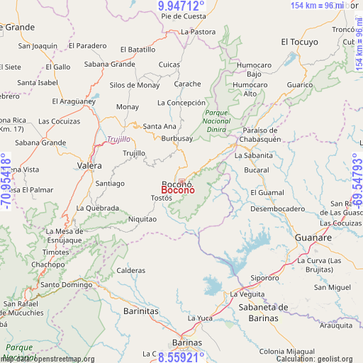
Boconó GPS coordinates[2]
9° 15' 13.86" North, 70° 15' 3.78" West
| Map corner | latitude | longitude |
|---|---|---|
| Upper-left | 9.94712°, | -70.95418° |
| Center: | 9.25385°, | -70.25105° |
| Lower-right: | 8.55921°, | -69.54793° |
| Map W x H: | 154.3×154.3 km | = 95.9×95.9mi |
| max Lat: | 11.94788° ⇑59% North |
| Boconó: | 9.25385° |
| min Lat: | ⇓41% South 1.92027° |
| min Long | Boconó | max Long |
| -72.55212° | -70.25105° | -60.99778° |
| W 31%⇐ | ⇒69% E |
Elevation
Elevation of Boconó is 1421 m = 4662 ft, and this is 1040.4 m = 3413 ft above average elevation for this country.
| Max E: |
2986 m = 9797 ft | 4.6% |
| Boconó | 1421 m 4662 ft | |
| Avg. | 380.6 m = 1249 ft | |
Min E: |
-4 m = -13 ft | 95.4% |
See also: Venezuela elevation on elevation.city.
Geographical zone
Boconó is located in North Torrid zone (between Equator and Tropic of Cancer). Distance of Equator is 1028.9 km =639.3 mi to South.| Distance of | km | miles | from Boconó |
|---|---|---|---|
| North Pole | 8978.1 | 5578.7 | to North |
| Arctic Circle | 6372.2 | 3959.5 | to North |
| Tropic Cancer | 1577 | 979.9 | to North |
| Equator | 1028.9 | 639.3 | to South |


Nearby cities:
15 places around Boconó: (largest is in red/bold)
• Biscucuy
31.7 km =19.7 mi,  68°
68°
• Calderas
43.5 km =27 mi,  209°
209°
• Campo Elías
26.3 km =16.3 mi,  53°
53°
• Carache
41.7 km =25.9 mi,  3°
3°
• Carvajal
37.7 km =23.4 mi,  278°
278°
• Chejendé
42.2 km =26.2 mi,  344°
344°
• Escuque
46.4 km =28.8 mi, 275°
• La Quebrada
37.4 km =23.2 mi,  252°
252°
• Masparrito
28.5 km =17.7 mi,  191°
191°
• Motatán
40.3 km =25 mi,  292°
292°
• Pampanito
32.5 km =20.2 mi,  302°
302°
• Pampán
32.5 km =20.2 mi,  310°
310°
• Paraíso de Chabasquén
38.8 km =24.1 mi,  59°
59°
• Trujillo
23.9 km =14.9 mi, 301°
• Valera
39.3 km =24.4 mi, 280°
Sources, notices
• [Note1] Compared only with cities in Venezuela existing in our database
• [Src1] Map data: © OpenStreetMap contributors (CC-BY-SA)
• [Src2] Other city data from geonames.org with taken over terms of usage.
• [Src3] Geographical zone / Annual Mean Temperature by Robert A. Rohde @ Wikipedia
