San Pablo geodata
San Pablo (Yaracuy) is a seat of a second-order administrative division; located in Venezuela in America/Caracas (GMT-4) time zone. In our database, there are 108 cities with bigger population. Compared to other cities in Venezuela, 71.2% of cities are located further ↓South; 50.1% of cities are located further →East and 65.4% of cities have lower elevation than San Pablo. Note1


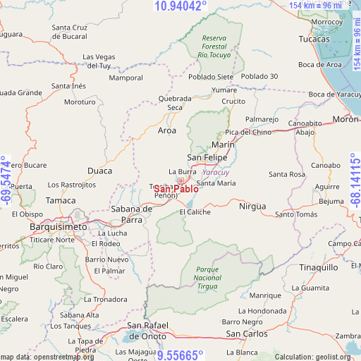
San Pablo GPS coordinates[2]
10° 14' 57.444" North, 68° 50' 39.372" West
| Map corner | latitude | longitude |
|---|---|---|
| Upper-left | 10.94042°, | -69.5474° |
| Center: | 10.24929°, | -68.84427° |
| Lower-right: | 9.55665°, | -68.14115° |
| Map W x H: | 153.9×153.9 km | = 95.6×95.6mi |
| max Lat: | 11.94788° ⇑28.8% North |
| San Pablo: | 10.24929° |
| min Lat: | ⇓71.2% South 1.92027° |
| min Long | San Pablo | max Long |
| -72.55212° | -68.84427° | -60.99778° |
| W 49.9%⇐ | ⇒50.1% E |
Elevation
Elevation of San Pablo is 312 m = 1024 ft, and this is 68.6 m = 225 ft below average elevation for this country.
| Max E: |
2986 m = 9797 ft | 34.6% |
| Avg. | 380.6 m = 1249 ft | |
| San Pablo | 312 m = 1024 ft | |
Min E: |
-4 m = -13 ft | 65.4% |
See also: Venezuela elevation on elevation.city.
Geographical zone
San Pablo is located in North Torrid zone (between Equator and Tropic of Cancer). Distance of Equator is 1139.6 km =708.1 mi to South.| Distance of | km | miles | from San Pablo |
|---|---|---|---|
| North Pole | 8867.4 | 5509.9 | to North |
| Arctic Circle | 6261.6 | 3890.8 | to North |
| Tropic Cancer | 1466.3 | 911.1 | to North |
| Equator | 1139.6 | 708.1 | to South |


Nearby cities:
15 places around San Pablo: (largest is in red/bold)
• Aroa
21.9 km =13.6 mi,  345°
345°
• Boraure
8.2 km =5.1 mi,  91°
91°
• Chivacoa
11.4 km =7.1 mi,  208°
208°
• Cocorote
10.3 km =6.4 mi,  40°
40°
• Duaca
35 km =21.7 mi,  276°
276°
• Farriar
39.7 km =24.7 mi,  51°
51°
• Guama
3.3 km =2.1 mi, 54°
• Independencia
13.6 km =8.5 mi, 45°
• Los Rastrojos
50.1 km =31.1 mi,  240°
240°
• Nirgua
32.5 km =20.2 mi,  109°
109°
• Sabana de Parra
25.4 km =15.8 mi, 235°
• San Felipe
15 km =9.3 mi, 47°
• Urachiche
20.5 km =12.7 mi, 240°
• Yaritagua
35.9 km =22.3 mi, 238°
• Yumare
42.9 km =26.7 mi,  25°
25°
Sources, notices
• [Note1] Compared only with cities in Venezuela existing in our database
• [Src1] Map data: © OpenStreetMap contributors (CC-BY-SA)
• [Src2] Other city data from geonames.org with taken over terms of usage.
• [Src3] Geographical zone / Annual Mean Temperature by Robert A. Rohde @ Wikipedia
