Los Rastrojos geodata
Los Rastrojos (Lara) is a populated place; located in Venezuela in America/Caracas (GMT-4) time zone. With population of 34,636 people, there are 92 cities with bigger population in this country. Compared to other cities in Venezuela, 58.8% of cities are located further ↓South; 55.5% of cities are located further →East and 70.7% of cities have lower elevation than Los Rastrojos. Note1


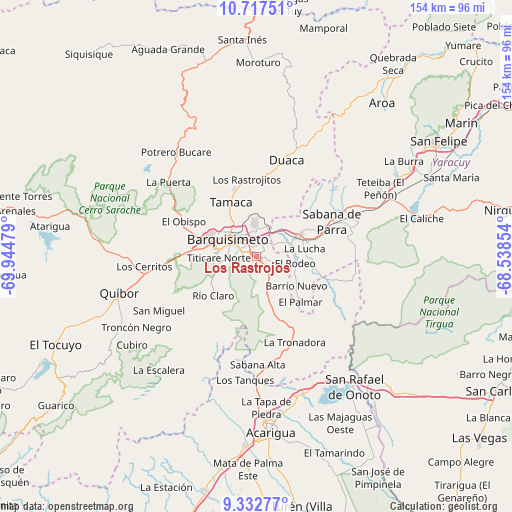
Los Rastrojos GPS coordinates[2]
10° 1' 33.168" North, 69° 14' 29.976" West
| Map corner | latitude | longitude |
|---|---|---|
| Upper-left | 10.71751°, | -69.94479° |
| Center: | 10.02588°, | -69.24166° |
| Lower-right: | 9.33277°, | -68.53854° |
| Map W x H: | 154×154 km | = 95.7×95.7mi |
| max Lat: | 11.94788° ⇑41.2% North |
| Los Rastrojos: | 10.02588° |
| min Lat: | ⇓58.8% South 1.92027° |
| min Long | Los Rastrojos | max Long |
| -72.55212° | -69.24166° | -60.99778° |
| W 44.5%⇐ | ⇒55.5% E |
Elevation
Elevation of Los Rastrojos is 446 m = 1463 ft, and this is 65.4 m = 215 ft above average elevation for this country.
| Max E: |
2986 m = 9797 ft | 29.3% |
| Los Rastrojos | 446 m 1463 ft | |
| Avg. | 380.6 m = 1249 ft | |
Min E: |
-4 m = -13 ft | 70.7% |
See also: Venezuela elevation on elevation.city.
Geographical zone
Los Rastrojos is located in North Torrid zone (between Equator and Tropic of Cancer). Distance of Equator is 1114.8 km =692.7 mi to South.| Distance of | km | miles | from Los Rastrojos |
|---|---|---|---|
| North Pole | 8892.3 | 5525.4 | to North |
| Arctic Circle | 6286.4 | 3906.2 | to North |
| Tropic Cancer | 1491.1 | 926.5 | to North |
| Equator | 1114.8 | 692.7 | to South |


Nearby cities:
15 places around Los Rastrojos: (largest is in red/bold)
• Acarigua
52.7 km =32.7 mi,  174°
174°
• Agua Blanca
43.1 km =26.8 mi,  159°
159°
• Araure
49.4 km =30.7 mi,  179°
179°
• Barquisimeto
13.3 km =8.3 mi,  288°
288°
• Cabudare
2.2 km =1.4 mi,  271°
271°
• Chivacoa
40.8 km =25.4 mi,  68°
68°
• Duaca
30.1 km =18.7 mi,  16°
16°
• Guama
53.4 km =33.2 mi,  59°
59°
• Quíbor
42.8 km =26.6 mi,  255°
255°
• Sabana de Parra
24.8 km =15.4 mi, 64°
• San Pablo
50.1 km =31.1 mi, 60°
• San Rafael de Onoto
48.6 km =30.2 mi,  142°
142°
• Sarare
28.5 km =17.7 mi, 162°
• Urachiche
29.5 km =18.3 mi, 60°
• Yaritagua
14.2 km =8.8 mi, 64°
Sources, notices
• [Note1] Compared only with cities in Venezuela existing in our database
• [Src1] Map data: © OpenStreetMap contributors (CC-BY-SA)
• [Src2] Other city data from geonames.org with taken over terms of usage.
• [Src3] Geographical zone / Annual Mean Temperature by Robert A. Rohde @ Wikipedia
