San Antonio del Golfo geodata
San Antonio del Golfo (Sucre) is a seat of a second-order administrative division; located in Venezuela in America/Caracas (GMT-4) time zone. In our database, there are 108 cities with bigger population. Compared to other cities in Venezuela, 79.1% of cities are located further ↓South; 90.3% of cities are located further ←West and 83% of cities have higher elevation than San Antonio del Golfo. Note1
Current local time in San Antonio del Golfo:
02:59 PM, ThursdayDifference from your time zone: hours


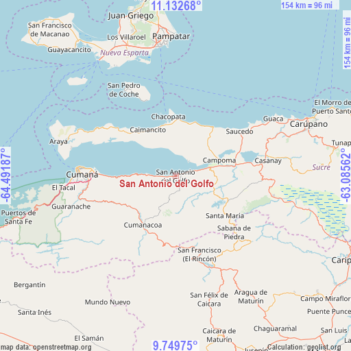
San Antonio del Golfo GPS coordinates[2]
10° 26' 31.128" North, 63° 47' 19.464" West
| Map corner | latitude | longitude |
|---|---|---|
| Upper-left | 11.13268°, | -64.49187° |
| Center: | 10.44198°, | -63.78874° |
| Lower-right: | 9.74975°, | -63.08562° |
| Map W x H: | 153.8×153.8 km | = 95.6×95.6mi |
| max Lat: | 11.94788° ⇑20.9% North |
| San Antonio del Golfo: | 10.44198° |
| min Lat: | ⇓79.1% South 1.92027° |
| min Long | San Antonio del | max Long |
| -72.55212° | -63.78874° | -60.99778° |
| W 90.3%⇐ | ⇒9.7% E |
Elevation
Elevation of San Antonio del Golfo is 39 m = 128 ft, and this is 341.6 m = 1121 ft below average elevation for this country.
| Max E: |
2986 m = 9797 ft | 83% |
| Avg. | 380.6 m = 1249 ft | |
| San Antonio del Golfo | 39 m = 128 ft | |
Min E: |
-4 m = -13 ft | 17% |
See also: Venezuela elevation on elevation.city.
Geographical zone
San Antonio del Golfo is located in North Torrid zone (between Equator and Tropic of Cancer). Distance of Equator is 1161 km =721.4 mi to South.| Distance of | km | miles | from San Antonio del Golfo |
|---|---|---|---|
| North Pole | 8846 | 5496.6 | to North |
| Arctic Circle | 6240.1 | 3877.4 | to North |
| Tropic Cancer | 1444.9 | 897.8 | to North |
| Equator | 1161 | 721.4 | to South |


Nearby cities:
15 places around San Antonio del Golfo: (largest is in red/bold)
• Aragua
62 km =38.5 mi,  147°
147°
• Araya
53.3 km =33.1 mi,  286°
286°
• Cariaco
26.5 km =16.5 mi,  76°
76°
• Caripe
43.4 km =27 mi,  133°
133°
• Casanay
41.2 km =25.6 mi, 80°
• Cumanacoa
25.6 km =15.9 mi,  213°
213°
• Cumaná
43.1 km =26.8 mi,  271°
271°
• El Valle del Espíritu Santo
61.1 km =38 mi,  350°
350°
• Marigüitar
12.4 km =7.7 mi, 273°
• Pampatar
62.2 km =38.6 mi,  359°
359°
• Porlamar
58 km =36 mi, 351°
• Punta de Piedras
61.2 km =38 mi,  326°
326°
• San Antonio
36.6 km =22.7 mi,  169°
169°
• San José de Aerocuar
53.3 km =33.1 mi,  70°
70°
• San Pedro de Coche
44 km =27.3 mi, 328°
Sources, notices
• [Note1] Compared only with cities in Venezuela existing in our database
• [Src1] Map data: © OpenStreetMap contributors (CC-BY-SA)
• [Src2] Other city data from geonames.org with taken over terms of usage.
• [Src3] Geographical zone / Annual Mean Temperature by Robert A. Rohde @ Wikipedia
