San Sebastián geodata
San Sebastián (Aragua) is a seat of a second-order administrative division; located in Venezuela in America/Caracas (GMT-4) time zone. In our database, there are 108 cities with bigger population. Compared to other cities in Venezuela, 57.3% of cities are located further ↓South; 67.2% of cities are located further ←West and 67.7% of cities have lower elevation than San Sebastián. Note1


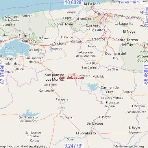
San Sebastián GPS coordinates[2]
9° 56' 27.888" North, 67° 10' 18.588" West
| Map corner | latitude | longitude |
|---|---|---|
| Upper-left | 10.6329°, | -67.87496° |
| Center: | 9.94108°, | -67.17183° |
| Lower-right: | 9.24779°, | -66.46871° |
| Map W x H: | 154×154 km | = 95.7×95.7mi |
| max Lat: | 11.94788° ⇑42.7% North |
| San Sebastián: | 9.94108° |
| min Lat: | ⇓57.3% South 1.92027° |
| min Long | San Sebastián | max Long |
| -72.55212° | -67.17183° | -60.99778° |
| W 67.2%⇐ | ⇒32.8% E |
Elevation
Elevation of San Sebastián is 359 m = 1178 ft, and this is 21.6 m = 71 ft below average elevation for this country.
| Max E: |
2986 m = 9797 ft | 32.3% |
| Avg. | 380.6 m = 1249 ft | |
| San Sebastián | 359 m = 1178 ft | |
Min E: |
-4 m = -13 ft | 67.7% |
See also: Venezuela elevation on elevation.city.
Geographical zone
San Sebastián is located in North Torrid zone (between Equator and Tropic of Cancer). Distance of Equator is 1105.3 km =686.8 mi to South.| Distance of | km | miles | from San Sebastián |
|---|---|---|---|
| North Pole | 8901.7 | 5531.3 | to North |
| Arctic Circle | 6295.8 | 3912 | to North |
| Tropic Cancer | 1500.6 | 932.4 | to North |
| Equator | 1105.3 | 686.8 | to South |


Nearby cities:
15 places around San Sebastián: (largest is in red/bold)
• Cagua
41.6 km =25.8 mi,  310°
310°
• Camatagua
33.7 km =20.9 mi,  120°
120°
• Cúa
40.1 km =24.9 mi,  52°
52°
• El Consejo
34.7 km =21.6 mi,  341°
341°
• La Victoria
36.2 km =22.5 mi,  331°
331°
• Las Tejerías
34.8 km =21.6 mi,  359°
359°
• Los Teques
47 km =29.2 mi,  17°
17°
• Ocumare del Tuy
47.7 km =29.6 mi,  65°
65°
• Ortiz
37.8 km =23.5 mi,  200°
200°
• San Casimiro
18.5 km =11.5 mi, 68°
• San Juan de los Morros
20.2 km =12.6 mi,  260°
260°
• San Mateo
40.9 km =25.4 mi,  317°
317°
• Santa Cruz
45.7 km =28.4 mi, 305°
• Turmero
46 km =28.6 mi, 313°
• Villa de Cura
36.4 km =22.6 mi,  287°
287°
Sources, notices
• [Note1] Compared only with cities in Venezuela existing in our database
• [Src1] Map data: © OpenStreetMap contributors (CC-BY-SA)
• [Src2] Other city data from geonames.org with taken over terms of usage.
• [Src3] Geographical zone / Annual Mean Temperature by Robert A. Rohde @ Wikipedia
