Las Tejerías geodata
Las Tejerías (Aragua) is a seat of a second-order administrative division; located in Venezuela in America/Caracas (GMT-4) time zone. With population of 33,320 people, there are 94 cities with bigger population in this country. Compared to other cities in Venezuela, 71.8% of cities are located further ↓South; 66.9% of cities are located further ←West and 76.8% of cities have lower elevation than Las Tejerías. Note1


Las Tejerías GPS coordinates[2]
10° 15' 14.976" North, 67° 10' 23.988" West
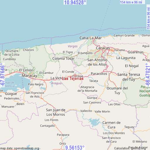
| Map corner | latitude | longitude |
|---|---|---|
| Upper-left | 10.94528°, | -67.87646° |
| Center: | 10.25416°, | -67.17333° |
| Lower-right: | 9.56153°, | -66.47021° |
| Map W x H: | 153.9×153.9 km | = 95.6×95.6mi |
| max Lat: | 11.94788° ⇑28.2% North |
| Las Tejerías: | 10.25416° |
| min Lat: | ⇓71.8% South 1.92027° |
| min Long | Las Tejerías | max Long |
| -72.55212° | -67.17333° | -60.99778° |
| W 66.9%⇐ | ⇒33.1% E |
Elevation
Elevation of Las Tejerías is 581 m = 1906 ft, and this is 200.4 m = 657 ft above average elevation for this country.
| Max E: |
2986 m = 9797 ft | 23.2% |
| Las Tejerías | 581 m 1906 ft | |
| Avg. | 380.6 m = 1249 ft | |
Min E: |
-4 m = -13 ft | 76.8% |
See also: Venezuela elevation on elevation.city.
Geographical zone
Las Tejerías is located in North Torrid zone (between Equator and Tropic of Cancer). Distance of Equator is 1140.2 km =708.5 mi to South.| Distance of | km | miles | from Las Tejerías |
|---|---|---|---|
| North Pole | 8866.9 | 5509.6 | to North |
| Arctic Circle | 6261 | 3890.4 | to North |
| Tropic Cancer | 1465.8 | 910.8 | to North |
| Equator | 1140.2 | 708.5 | to South |


Nearby cities:
15 places around Las Tejerías: (largest is in red/bold)
• Cagua
32.2 km =20 mi,  256°
256°
• Caricuao
28.8 km =17.9 mi,  46°
46°
• Carrizal
23.1 km =14.4 mi,  62°
62°
• Charallave
34.6 km =21.5 mi,  92°
92°
• Cúa
33.4 km =20.8 mi,  107°
107°
• El Consejo
10.7 km =6.6 mi, 260°
• El Junko
26.2 km =16.3 mi,  22°
22°
• La Victoria
17.5 km =10.9 mi, 260°
• Los Teques
17.4 km =10.8 mi, 54°
• San Antonio de Los Altos
28.5 km =17.7 mi, 58°
• San Casimiro
33 km =20.5 mi,  148°
148°
• San Mateo
27.8 km =17.3 mi, 260°
• San Sebastián
34.8 km =21.6 mi,  179°
179°
• Santa Cruz
37.9 km =23.5 mi, 257°
• Turmero
33 km =20.5 mi,  265°
265°
In other languages:
- In Spanish: Tejerias, Las Tejerías
- In France: Las Tejerías, Tejerias
- In German: Las Tejerías, Tejerias
- In Italian: Las Tejerías, Tejerias
Sources, notices
• [Note1] Compared only with cities in Venezuela existing in our database
• [Src1] Map data: © OpenStreetMap contributors (CC-BY-SA)
• [Src2] Other city data from geonames.org with taken over terms of usage.
• [Src3] Geographical zone / Annual Mean Temperature by Robert A. Rohde @ Wikipedia
