Thị Trấn Việt Lâm geodata
Thị Trấn Việt Lâm (Hà Giang) is a seat of a second-order administrative division; located in Vietnam in Asia/Ho_Chi_Minh (GMT+7) time zone. In our database, there are 94 cities with bigger population. Compared to other cities in Vietnam, 96.2% of cities are located further ↓South; 90.7% of cities are located further →East and 73.4% of cities have lower elevation than Thị Trấn Việt Lâm. Note1


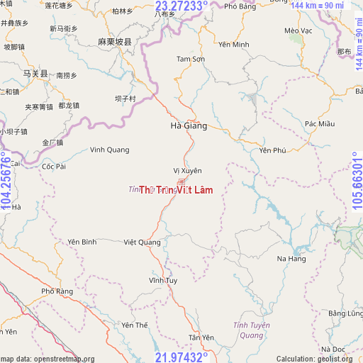
Thị Trấn Việt Lâm GPS coordinates[2]
22° 37' 29.496" North, 104° 57' 35.568" East
| Map corner | latitude | longitude |
|---|---|---|
| Upper-left | 23.27233°, | 104.25676° |
| Center: | 22.62486°, | 104.95988° |
| Lower-right: | 21.97432°, | 105.66301° |
| Map W x H: | 144.3×144.3 km | = 89.7×89.7mi |
| max Lat: | 23.27841° ⇑3.8% North |
| Thị Trấn Việt Lâm: | 22.62486° |
| min Lat: | ⇓96.2% South 8.65724° |
| min Long | Thị Trấn Vi | max Long |
| 102.4579° | 104.95988° | 112.72541° |
| W 9.3%⇐ | ⇒90.7% E |
Elevation
Elevation of Thị Trấn Việt Lâm is 79 m = 259 ft, and this is 50.5 m = 166 ft below average elevation for this country.
| Max E: |
1592 m = 5223 ft | 26.6% |
| Avg. | 129.5 m = 425 ft | |
| Thị Trấn Việt Lâm | 79 m = 259 ft | |
Min E: |
-1 m = -3 ft | 73.4% |
See also: Vietnam elevation on elevation.city.
Geographical zone
Thị Trấn Việt Lâm is located in North Torrid zone (between Equator and Tropic of Cancer). Distance of this Northern Tropic circle is 90.3 km =56.1 mi to North.| Distance of | km | miles | from Thị Trấn Việt Lâm |
|---|---|---|---|
| North Pole | 7491.4 | 4654.9 | to North |
| Arctic Circle | 4885.5 | 3035.7 | to North |
| Tropic Cancer | 90.3 | 56.1 | to North |
| Equator | 2515.6 | 1563.1 | to South |


Nearby cities:
15 places around Thị Trấn Việt Lâm: (largest is in red/bold)
• Huyện Chiêm Hóa
62.4 km =38.8 mi,  148°
148°
• Hà Giang
22.2 km =13.8 mi,  6°
6°
• Lũng Hồ
49.2 km =30.6 mi,  35°
35°
• Pác Miầu
59.3 km =36.8 mi,  67°
67°
• Thị Trấn Na Hang
53.1 km =33 mi,  125°
125°
• Thị Trấn Tam Sơn
49.3 km =30.6 mi,  3°
3°
• Thị Trấn Vinh Quang
31.5 km =19.6 mi,  294°
294°
• Thị Trấn Việt Quang
28.1 km =17.5 mi,  213°
213°
• Thị Trấn Vĩnh Tuy
39.6 km =24.6 mi,  190°
190°
• Thị Trấn Vị Xuyên
5.3 km =3.3 mi,  25°
25°
• Thị Trấn Yên Minh
57.9 km =36 mi,  18°
18°
• Thị Trấn Yên Thế
60.5 km =37.6 mi,  199°
199°
• Tân Việt
57.7 km =35.9 mi,  62°
62°
• Yên Bình
45.8 km =28.5 mi,  238°
238°
• Yên Phú
43.9 km =27.3 mi, 74°
Sources, notices
• [Note1] Compared only with cities in Vietnam existing in our database
• [Src1] Map data: © OpenStreetMap contributors (CC-BY-SA)
• [Src2] Other city data from geonames.org with taken over terms of usage.
• [Src3] Geographical zone / Annual Mean Temperature by Robert A. Rohde @ Wikipedia
