Ít Ong geodata
Ít Ong (Sơn La) is a seat of a second-order administrative division; located in Vietnam in Asia/Ho_Chi_Minh (GMT+7) time zone. In our database, there are 94 cities with bigger population. Compared to other cities in Vietnam, 86.1% of cities are located further ↓South; 96.1% of cities are located further →East and 82.2% of cities have lower elevation than Ít Ong. Note1


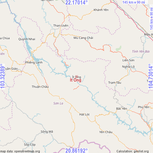
Ít Ong GPS coordinates[2]
21° 31' 3" North, 104° 1' 37.236" East
| Map corner | latitude | longitude |
|---|---|---|
| Upper-left | 22.17014°, | 103.32389° |
| Center: | 21.5175°, | 104.02701° |
| Lower-right: | 20.86192°, | 104.73014° |
| Map W x H: | 145.5×145.5 km | = 90.4×90.4mi |
| max Lat: | 23.27841° ⇑13.9% North |
| Ít Ong: | 21.5175° |
| min Lat: | ⇓86.1% South 8.65724° |
| min Long | Ít Ong | max Long |
| 102.4579° | 104.02701° | 112.72541° |
| W 3.9%⇐ | ⇒96.1% E |
Elevation
Elevation of Ít Ong is 206 m = 676 ft, and this is 76.5 m = 251 ft above average elevation for this country.
| Max E: |
1592 m = 5223 ft | 17.8% |
| Ít Ong | 206 m 676 ft | |
| Avg. | 129.5 m = 425 ft | |
Min E: |
-1 m = -3 ft | 82.2% |
See also: Vietnam elevation on elevation.city.
Geographical zone
Ít Ong is located in North Torrid zone (between Equator and Tropic of Cancer). Distance of this Northern Tropic circle is 213.4 km =132.6 mi to North.| Distance of | km | miles | from Ít Ong |
|---|---|---|---|
| North Pole | 7614.5 | 4731.4 | to North |
| Arctic Circle | 5008.7 | 3112.3 | to North |
| Tropic Cancer | 213.4 | 132.6 | to North |
| Equator | 2392.5 | 1486.6 | to South |


Nearby cities:
15 places around Ít Ong: (largest is in red/bold)
• Bắc Yên
51.7 km =32.1 mi,  125°
125°
• Hát Lót
36.5 km =22.7 mi,  167°
167°
• Mù Cang Chải
37.7 km =23.4 mi,  9°
9°
• Mường Chiên
59.8 km =37.2 mi,  307°
307°
• Phù Yên
69.9 km =43.4 mi,  113°
113°
• Sông Mã
59.3 km =36.8 mi,  208°
208°
• Sơn La
24.1 km =15 mi, 207°
• Sơn Thịnh
58.9 km =36.6 mi,  85°
85°
• Than Uyên
51.4 km =31.9 mi,  342°
342°
• Thị Trấn Khánh Yên
67.7 km =42.1 mi,  20°
20°
• Thị Trấn Thuận Châu
36 km =22.4 mi,  255°
255°
• Thị Trấn Trạm Tấu
36.9 km =22.9 mi,  98°
98°
• Thị Trấn Tuần Giáo
63.1 km =39.2 mi,  277°
277°
• Thị Trấn Tủa Chùa
80.2 km =49.8 mi,  298°
298°
• Yên Châu
59.6 km =37 mi,  151°
151°
Sources, notices
• [Note1] Compared only with cities in Vietnam existing in our database
• [Src1] Map data: © OpenStreetMap contributors (CC-BY-SA)
• [Src2] Other city data from geonames.org with taken over terms of usage.
• [Src3] Geographical zone / Annual Mean Temperature by Robert A. Rohde @ Wikipedia
