Than Uyên geodata
Than Uyên (Lai Châu) is a seat of a second-order administrative division; located in Vietnam in Asia/Ho_Chi_Minh (GMT+7) time zone. In our database, there are 94 cities with bigger population. Compared to other cities in Vietnam, 90.5% of cities are located further ↓South; 96.9% of cities are located further →East and 92.7% of cities have lower elevation than Than Uyên. Note1


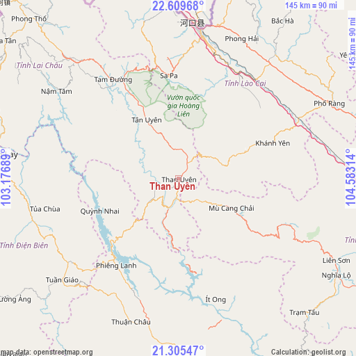
Than Uyên GPS coordinates[2]
21° 57' 32.652" North, 103° 52' 48.036" East
| Map corner | latitude | longitude |
|---|---|---|
| Upper-left | 22.60968°, | 103.17689° |
| Center: | 21.95907°, | 103.88001° |
| Lower-right: | 21.30547°, | 104.58314° |
| Map W x H: | 145×145 km | = 90.1×90.1mi |
| max Lat: | 23.27841° ⇑9.5% North |
| Than Uyên: | 21.95907° |
| min Lat: | ⇓90.5% South 8.65724° |
| min Long | Than Uyên | max Long |
| 102.4579° | 103.88001° | 112.72541° |
| W 3.1%⇐ | ⇒96.9% E |
Elevation
Elevation of Than Uyên is 587 m = 1926 ft, and this is 457.5 m = 1501 ft above average elevation for this country.
| Max E: |
1592 m = 5223 ft | 7.3% |
| Than Uyên | 587 m 1926 ft | |
| Avg. | 129.5 m = 425 ft | |
Min E: |
-1 m = -3 ft | 92.7% |
See also: Vietnam elevation on elevation.city.
Geographical zone
Than Uyên is located in North Torrid zone (between Equator and Tropic of Cancer). Distance of this Northern Tropic circle is 164.3 km =102.1 mi to North.| Distance of | km | miles | from Than Uyên |
|---|---|---|---|
| North Pole | 7565.4 | 4700.9 | to North |
| Arctic Circle | 4959.6 | 3081.8 | to North |
| Tropic Cancer | 164.3 | 102.1 | to North |
| Equator | 2441.6 | 1517.1 | to South |


Nearby cities:
15 places around Than Uyên: (largest is in red/bold)
• Bát Xát
64.9 km =40.3 mi,  0°
0°
• Cát Cát
41.7 km =25.9 mi,  352°
352°
• Lai Châu
65.2 km =40.5 mi,  318°
318°
• Lao Chải
39.5 km =24.5 mi,  358°
358°
• Lào Cai
59.3 km =36.8 mi,  9°
9°
• Mù Cang Chải
24.7 km =15.3 mi,  119°
119°
• Mường Chiên
34.9 km =21.7 mi,  248°
248°
• Sa Pa
42.5 km =26.4 mi, 355°
• Tam Đường
47.7 km =29.6 mi,  326°
326°
• Thị Trấn Khánh Yên
40.9 km =25.4 mi,  69°
69°
• Thị Trấn Phố Lu
51 km =31.7 mi,  38°
38°
• Thị Trấn Thuận Châu
61.1 km =38 mi,  198°
198°
• Thị Trấn Tuần Giáo
62.6 km =38.9 mi,  229°
229°
• Thị Trấn Tủa Chùa
56.6 km =35.2 mi,  258°
258°
• Ít Ong
51.4 km =31.9 mi,  162°
162°
Sources, notices
• [Note1] Compared only with cities in Vietnam existing in our database
• [Src1] Map data: © OpenStreetMap contributors (CC-BY-SA)
• [Src2] Other city data from geonames.org with taken over terms of usage.
• [Src3] Geographical zone / Annual Mean Temperature by Robert A. Rohde @ Wikipedia
