Thị Trấn Sìn Hồ geodata
Thị Trấn Sìn Hồ (Lai Châu) is a seat of a second-order administrative division; located in Vietnam in Asia/Ho_Chi_Minh (GMT+7) time zone. In our database, there are 94 cities with bigger population. Compared to other cities in Vietnam, 94.1% of cities are located further ↓South; 98.9% of cities are located further →East and 100% of cities have lower elevation than Thị Trấn Sìn Hồ. Note1


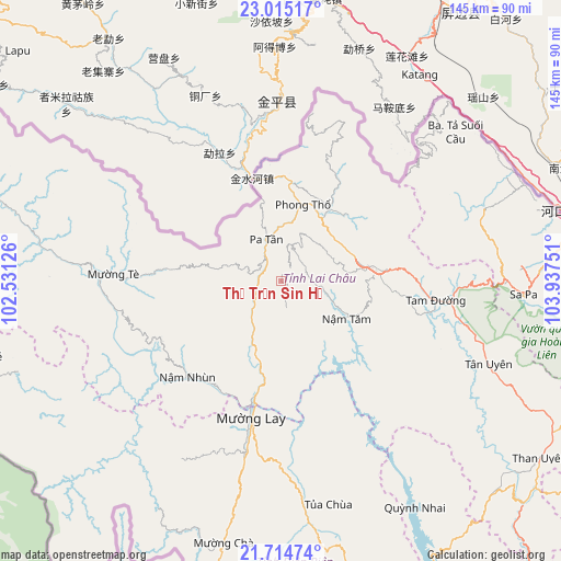
Thị Trấn Sìn Hồ GPS coordinates[2]
22° 21' 59.292" North, 103° 14' 3.768" East
| Map corner | latitude | longitude |
|---|---|---|
| Upper-left | 23.01517°, | 102.53126° |
| Center: | 22.36647°, | 103.23438° |
| Lower-right: | 21.71474°, | 103.93751° |
| Map W x H: | 144.6×144.6 km | = 89.9×89.9mi |
| max Lat: | 23.27841° ⇑5.9% North |
| Thị Trấn Sìn Hồ: | 22.36647° |
| min Lat: | ⇓94.1% South 8.65724° |
| min Long | Thị Trấn S� | max Long |
| 102.4579° | 103.23438° | 112.72541° |
| W 1.1%⇐ | ⇒98.9% E |
Elevation
Elevation of Thị Trấn Sìn Hồ is 1592 m = 5223 ft, and this is 1462.5 m = 4798 ft above average elevation for this country.
| Max E: |
1592 m = 5223 ft | 0% |
| Thị Trấn Sìn Hồ | 1592 m 5223 ft | |
| Avg. | 129.5 m = 425 ft | |
Min E: |
-1 m = -3 ft | 100% |
See also: Vietnam elevation on elevation.city.
Geographical zone
Thị Trấn Sìn Hồ is located in North Torrid zone (between Equator and Tropic of Cancer). Distance of this Northern Tropic circle is 119 km =73.9 mi to North.| Distance of | km | miles | from Thị Trấn Sìn Hồ |
|---|---|---|---|
| North Pole | 7520.1 | 4672.8 | to North |
| Arctic Circle | 4914.3 | 3053.6 | to North |
| Tropic Cancer | 119 | 73.9 | to North |
| Equator | 2486.9 | 1545.3 | to South |


Nearby cities:
15 places around Thị Trấn Sìn Hồ: (largest is in red/bold)
• Bát Xát
70.2 km =43.6 mi,  73°
73°
• Cát Cát
60.9 km =37.8 mi,  93°
93°
• Lai Châu
23.3 km =14.5 mi,  81°
81°
• Lao Chải
65.5 km =40.7 mi,  95°
95°
• Lào Cai
76.8 km =47.7 mi, 80°
• Mường Chiên
67.6 km =42 mi,  149°
149°
• Mường Chà
68.7 km =42.7 mi,  191°
191°
• Mường Nhé
82.2 km =51.1 mi,  256°
256°
• Phong Thổ
20.8 km =12.9 mi,  18°
18°
• Sa Pa
62.8 km =39 mi, 92°
• Tam Đường
40.7 km =25.3 mi, 97°
• Than Uyên
80.4 km =50 mi,  124°
124°
• Thị Trấn Mường Tè
42.6 km =26.5 mi,  272°
272°
• Thị Trấn Tuần Giáo
88.5 km =55 mi,  167°
167°
• Thị Trấn Tủa Chùa
57.7 km =35.9 mi, 168°
Sources, notices
• [Note1] Compared only with cities in Vietnam existing in our database
• [Src1] Map data: © OpenStreetMap contributors (CC-BY-SA)
• [Src2] Other city data from geonames.org with taken over terms of usage.
• [Src3] Geographical zone / Annual Mean Temperature by Robert A. Rohde @ Wikipedia
