Lâm Thao geodata
Lâm Thao (Phú Thọ) is a seat of a second-order administrative division; located in Vietnam in Asia/Ho_Chi_Minh (GMT+7) time zone. In our database, there are 94 cities with bigger population. Compared to other cities in Vietnam, 82.5% of cities are located further ↓South; 82.9% of cities are located further →East and 57.1% of cities have lower elevation than Lâm Thao. Note1


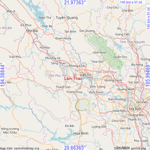
Lâm Thao GPS coordinates[2]
21° 19' 12.36" North, 105° 17' 29.616" East
| Map corner | latitude | longitude |
|---|---|---|
| Upper-left | 21.97363°, | 104.58844° |
| Center: | 21.3201°, | 105.29156° |
| Lower-right: | 20.66365°, | 105.99469° |
| Map W x H: | 145.7×145.7 km | = 90.5×90.5mi |
| max Lat: | 23.27841° ⇑17.5% North |
| Lâm Thao: | 21.3201° |
| min Lat: | ⇓82.5% South 8.65724° |
| min Long | Lâm Thao | max Long |
| 102.4579° | 105.29156° | 112.72541° |
| W 17.1%⇐ | ⇒82.9% E |
Elevation
Elevation of Lâm Thao is 19 m = 62 ft, and this is 110.5 m = 363 ft below average elevation for this country.
| Max E: |
1592 m = 5223 ft | 42.9% |
| Avg. | 129.5 m = 425 ft | |
| Lâm Thao | 19 m = 62 ft | |
Min E: |
-1 m = -3 ft | 57.1% |
See also: Vietnam elevation on elevation.city.
Geographical zone
Lâm Thao is located in North Torrid zone (between Equator and Tropic of Cancer). Distance of this Northern Tropic circle is 235.3 km =146.2 mi to North.| Distance of | km | miles | from Lâm Thao |
|---|---|---|---|
| North Pole | 7636.5 | 4745.1 | to North |
| Arctic Circle | 5030.6 | 3125.9 | to North |
| Tropic Cancer | 235.3 | 146.2 | to North |
| Equator | 2370.6 | 1473 | to South |


Nearby cities:
15 places around Lâm Thao: (largest is in red/bold)
• Hưng Hóa
7.3 km =4.5 mi,  176°
176°
• Hợp Hòa
26.7 km =16.6 mi,  76°
76°
• Lập Thạch
20.5 km =12.7 mi,  58°
58°
• Phong Châu
9.9 km =6.2 mi,  12°
12°
• Phú Thọ
11.4 km =7.1 mi,  320°
320°
• Sông Thao
19.8 km =12.3 mi,  304°
304°
• Sơn Tây
29.9 km =18.6 mi,  131°
131°
• Thanh Ba
25.3 km =15.7 mi, 321°
• Thanh Sơn
17.8 km =11.1 mi,  220°
220°
• Thanh Thủy
16.1 km =10 mi, 182°
• Tây Đằng
19.2 km =11.9 mi,  135°
135°
• Việt Trì
11.4 km =7.1 mi,  88°
88°
• Vĩnh Tường
25.6 km =15.9 mi,  116°
116°
• Yên Lạc
30.6 km =19 mi,  107°
107°
• Yên Lập
24.4 km =15.2 mi,  277°
277°
Sources, notices
• [Note1] Compared only with cities in Vietnam existing in our database
• [Src1] Map data: © OpenStreetMap contributors (CC-BY-SA)
• [Src2] Other city data from geonames.org with taken over terms of usage.
• [Src3] Geographical zone / Annual Mean Temperature by Robert A. Rohde @ Wikipedia
