Tây Đằng geodata
Tây Đằng (Hanoi) is a seat of a second-order administrative division; located in Vietnam in Asia/Ho_Chi_Minh (GMT+7) time zone. In our database, there are 94 cities with bigger population. Compared to other cities in Vietnam, 79.8% of cities are located further ↓South; 79.4% of cities are located further →East and 57.1% of cities have lower elevation than Tây Đằng. Note1


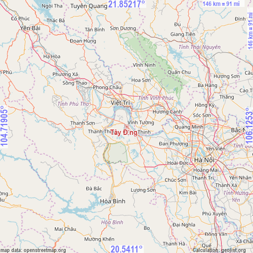
Tây Đằng GPS coordinates[2]
21° 11' 53.124" North, 105° 25' 19.812" East
| Map corner | latitude | longitude |
|---|---|---|
| Upper-left | 21.85217°, | 104.71905° |
| Center: | 21.19809°, | 105.42217° |
| Lower-right: | 20.5411°, | 106.1253° |
| Map W x H: | 145.8×145.8 km | = 90.6×90.6mi |
| max Lat: | 23.27841° ⇑20.2% North |
| Tây Đằng: | 21.19809° |
| min Lat: | ⇓79.8% South 8.65724° |
| min Long | Tây Đằng | max Long |
| 102.4579° | 105.42217° | 112.72541° |
| W 20.6%⇐ | ⇒79.4% E |
Elevation
Elevation of Tây Đằng is 19 m = 62 ft, and this is 110.5 m = 363 ft below average elevation for this country.
| Max E: |
1592 m = 5223 ft | 42.9% |
| Avg. | 129.5 m = 425 ft | |
| Tây Đằng | 19 m = 62 ft | |
Min E: |
-1 m = -3 ft | 57.1% |
See also: Vietnam elevation on elevation.city.
Geographical zone
Tây Đằng is located in North Torrid zone (between Equator and Tropic of Cancer). Distance of this Northern Tropic circle is 248.9 km =154.7 mi to North.| Distance of | km | miles | from Tây Đằng |
|---|---|---|---|
| North Pole | 7650.1 | 4753.6 | to North |
| Arctic Circle | 5044.2 | 3134.3 | to North |
| Tropic Cancer | 248.9 | 154.7 | to North |
| Equator | 2357 | 1464.6 | to South |


Nearby cities:
15 places around Tây Đằng: (largest is in red/bold)
• Hưng Hóa
14.6 km =9.1 mi,  295°
295°
• Hương Canh
25 km =15.5 mi,  68°
68°
• Hợp Hòa
23.3 km =14.5 mi,  32°
32°
• Liên Quan
22.6 km =14 mi,  133°
133°
• Lâm Thao
19.2 km =11.9 mi,  315°
315°
• Lập Thạch
24.5 km =15.2 mi,  9°
9°
• Phong Châu
25.8 km =16 mi,  333°
333°
• Phúc Thọ
16.6 km =10.3 mi, 129°
• Sơn Tây
10.9 km =6.8 mi, 126°
• Thanh Sơn
25.2 km =15.7 mi,  270°
270°
• Thanh Thủy
14.6 km =9.1 mi,  260°
260°
• Việt Trì
14 km =8.7 mi,  351°
351°
• Vĩnh Tường
9.6 km =6 mi,  77°
77°
• Vĩnh Yên
22.6 km =14 mi,  56°
56°
• Yên Lạc
16.2 km =10.1 mi, 74°
Sources, notices
• [Note1] Compared only with cities in Vietnam existing in our database
• [Src1] Map data: © OpenStreetMap contributors (CC-BY-SA)
• [Src2] Other city data from geonames.org with taken over terms of usage.
• [Src3] Geographical zone / Annual Mean Temperature by Robert A. Rohde @ Wikipedia
