Hợp Hòa geodata
Hợp Hòa (Vĩnh Phúc) is a seat of a second-order administrative division; located in Vietnam in Asia/Ho_Chi_Minh (GMT+7) time zone. In our database, there are 94 cities with bigger population. Compared to other cities in Vietnam, 83.7% of cities are located further ↓South; 75% of cities are located further →East and 58.4% of cities have lower elevation than Hợp Hòa. Note1


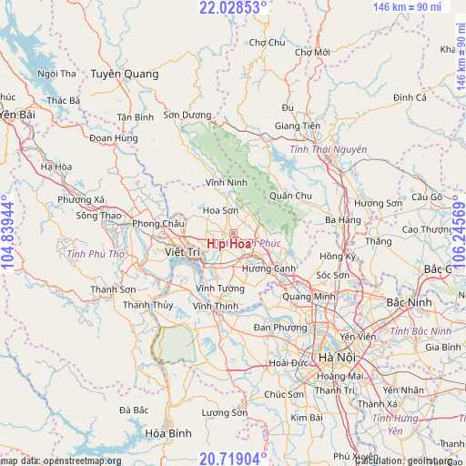
Hợp Hòa GPS coordinates[2]
21° 22' 30.9" North, 105° 32' 33.216" East
| Map corner | latitude | longitude |
|---|---|---|
| Upper-left | 22.02853°, | 104.83944° |
| Center: | 21.37525°, | 105.54256° |
| Lower-right: | 20.71904°, | 106.24569° |
| Map W x H: | 145.6×145.6 km | = 90.5×90.5mi |
| max Lat: | 23.27841° ⇑16.3% North |
| Hợp Hòa: | 21.37525° |
| min Lat: | ⇓83.7% South 8.65724° |
| min Long | Hợp Hòa | max Long |
| 102.4579° | 105.54256° | 112.72541° |
| W 25%⇐ | ⇒75% E |
Elevation
Elevation of Hợp Hòa is 21 m = 69 ft, and this is 108.5 m = 356 ft below average elevation for this country.
| Max E: |
1592 m = 5223 ft | 41.6% |
| Avg. | 129.5 m = 425 ft | |
| Hợp Hòa | 21 m = 69 ft | |
Min E: |
-1 m = -3 ft | 58.4% |
See also: Vietnam elevation on elevation.city.
Geographical zone
Hợp Hòa is located in North Torrid zone (between Equator and Tropic of Cancer). Distance of this Northern Tropic circle is 229.2 km =142.4 mi to North.| Distance of | km | miles | from Hợp Hòa |
|---|---|---|---|
| North Pole | 7630.4 | 4741.3 | to North |
| Arctic Circle | 5024.5 | 3122.1 | to North |
| Tropic Cancer | 229.2 | 142.4 | to North |
| Equator | 2376.7 | 1476.8 | to South |


Nearby cities:
15 places around Hợp Hòa: (largest is in red/bold)
• Hưng Hóa
28.9 km =18 mi,  242°
242°
• Hương Canh
15.2 km =9.4 mi,  134°
134°
• Lâm Thao
26.7 km =16.6 mi,  256°
256°
• Lập Thạch
9.6 km =6 mi,  297°
297°
• Mê Linh
28.2 km =17.5 mi,  139°
139°
• Phong Châu
24.1 km =15 mi,  278°
278°
• Phúc Thọ
30.2 km =18.8 mi,  179°
179°
• Phúc Yên
22.8 km =14.2 mi, 132°
• Sơn Tây
26.4 km =16.4 mi,  188°
188°
• Trai Ngau
7.7 km =4.8 mi,  74°
74°
• Tây Đằng
23.3 km =14.5 mi,  212°
212°
• Việt Trì
15.7 km =9.8 mi,  248°
248°
• Vĩnh Tường
17.9 km =11.1 mi, 190°
• Vĩnh Yên
9.8 km =6.1 mi, 138°
• Yên Lạc
15.8 km =9.8 mi,  168°
168°
Sources, notices
• [Note1] Compared only with cities in Vietnam existing in our database
• [Src1] Map data: © OpenStreetMap contributors (CC-BY-SA)
• [Src2] Other city data from geonames.org with taken over terms of usage.
• [Src3] Geographical zone / Annual Mean Temperature by Robert A. Rohde @ Wikipedia
