Lập Thạch geodata
Lập Thạch (Vĩnh Phúc) is a seat of a second-order administrative division; located in Vietnam in Asia/Ho_Chi_Minh (GMT+7) time zone. In our database, there are 94 cities with bigger population. Compared to other cities in Vietnam, 84.7% of cities are located further ↓South; 78% of cities are located further →East and 63.1% of cities have lower elevation than Lập Thạch. Note1


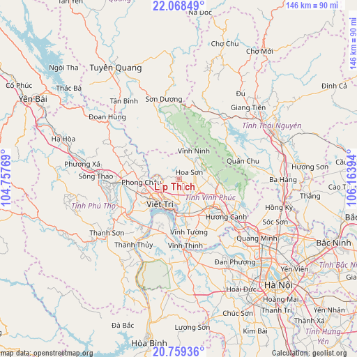
Lập Thạch GPS coordinates[2]
21° 24' 55.404" North, 105° 27' 38.916" East
| Map corner | latitude | longitude |
|---|---|---|
| Upper-left | 22.06849°, | 104.75769° |
| Center: | 21.41539°, | 105.46081° |
| Lower-right: | 20.75936°, | 106.16394° |
| Map W x H: | 145.6×145.6 km | = 90.5×90.5mi |
| max Lat: | 23.27841° ⇑15.3% North |
| Lập Thạch: | 21.41539° |
| min Lat: | ⇓84.7% South 8.65724° |
| min Long | Lập Thạch | max Long |
| 102.4579° | 105.46081° | 112.72541° |
| W 22%⇐ | ⇒78% E |
Elevation
Elevation of Lập Thạch is 30 m = 98 ft, and this is 99.5 m = 326 ft below average elevation for this country.
| Max E: |
1592 m = 5223 ft | 36.9% |
| Avg. | 129.5 m = 425 ft | |
| Lập Thạch | 30 m = 98 ft | |
Min E: |
-1 m = -3 ft | 63.1% |
See also: Vietnam elevation on elevation.city.
Geographical zone
Lập Thạch is located in North Torrid zone (between Equator and Tropic of Cancer). Distance of this Northern Tropic circle is 224.8 km =139.7 mi to North.| Distance of | km | miles | from Lập Thạch |
|---|---|---|---|
| North Pole | 7625.9 | 4738.5 | to North |
| Arctic Circle | 5020 | 3119.3 | to North |
| Tropic Cancer | 224.8 | 139.7 | to North |
| Equator | 2381.2 | 1479.6 | to South |


Nearby cities:
15 places around Lập Thạch: (largest is in red/bold)
• Hưng Hóa
24.7 km =15.3 mi,  223°
223°
• Hương Canh
24.5 km =15.2 mi,  128°
128°
• Hợp Hòa
9.6 km =6 mi,  117°
117°
• Lâm Thao
20.5 km =12.7 mi,  238°
238°
• Phong Châu
15.4 km =9.6 mi,  266°
266°
• Phú Thọ
24.8 km =15.4 mi, 265°
• Phúc Yên
32.1 km =19.9 mi, 128°
• Sơn Dương
31.9 km =19.8 mi,  348°
348°
• Sơn Tây
30.9 km =19.2 mi,  171°
171°
• Trai Ngau
16.1 km =10 mi,  98°
98°
• Tây Đằng
24.5 km =15.2 mi,  189°
189°
• Việt Trì
12 km =7.5 mi,  210°
210°
• Vĩnh Tường
22.8 km =14.2 mi, 166°
• Vĩnh Yên
19 km =11.8 mi, 128°
• Yên Lạc
23 km =14.3 mi,  149°
149°
Sources, notices
• [Note1] Compared only with cities in Vietnam existing in our database
• [Src1] Map data: © OpenStreetMap contributors (CC-BY-SA)
• [Src2] Other city data from geonames.org with taken over terms of usage.
• [Src3] Geographical zone / Annual Mean Temperature by Robert A. Rohde @ Wikipedia
