Quốc Oai geodata
Quốc Oai (Hanoi) is a seat of a second-order administrative division; located in Vietnam in Asia/Ho_Chi_Minh (GMT+7) time zone. In our database, there are 94 cities with bigger population. Compared to other cities in Vietnam, 74.1% of cities are located further ↓South; 71.3% of cities are located further →East and 54.8% of cities have higher elevation than Quốc Oai. Note1


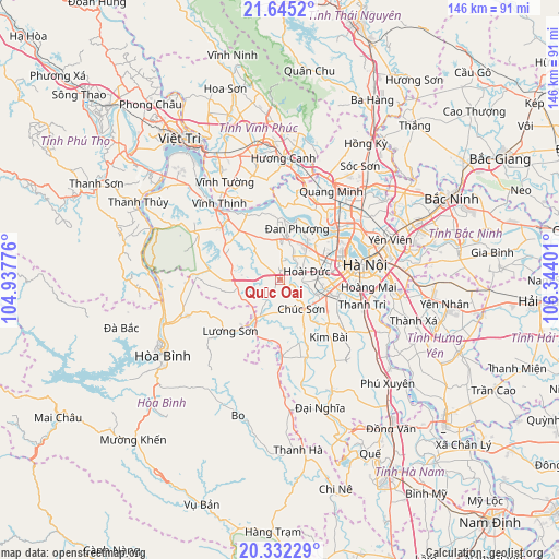
Quốc Oai GPS coordinates[2]
20° 59' 24.684" North, 105° 38' 27.168" East
| Map corner | latitude | longitude |
|---|---|---|
| Upper-left | 21.6452°, | 104.93776° |
| Center: | 20.99019°, | 105.64088° |
| Lower-right: | 20.33229°, | 106.34401° |
| Map W x H: | 146×146 km | = 90.7×90.7mi |
| max Lat: | 23.27841° ⇑25.9% North |
| Quốc Oai: | 20.99019° |
| min Lat: | ⇓74.1% South 8.65724° |
| min Long | Quốc Oai | max Long |
| 102.4579° | 105.64088° | 112.72541° |
| W 28.7%⇐ | ⇒71.3% E |
Elevation
Elevation of Quốc Oai is 12 m = 39 ft, and this is 117.5 m = 385 ft below average elevation for this country.
| Max E: |
1592 m = 5223 ft | 54.8% |
| Avg. | 129.5 m = 425 ft | |
| Quốc Oai | 12 m = 39 ft | |
Min E: |
-1 m = -3 ft | 45.2% |
See also: Vietnam elevation on elevation.city.
Geographical zone
Quốc Oai is located in North Torrid zone (between Equator and Tropic of Cancer). Distance of this Northern Tropic circle is 272 km =169 mi to North.| Distance of | km | miles | from Quốc Oai |
|---|---|---|---|
| North Pole | 7673.2 | 4767.9 | to North |
| Arctic Circle | 5067.3 | 3148.7 | to North |
| Tropic Cancer | 272 | 169 | to North |
| Equator | 2333.9 | 1450.2 | to South |


Nearby cities:
15 places around Quốc Oai: (largest is in red/bold)
• Chúc Sơn
9.7 km =6 mi,  139°
139°
• Cầu Diễn
14.1 km =8.8 mi,  67°
67°
• Cầu Giấy
17.2 km =10.7 mi, 74°
• Hai BàTrưng
21.6 km =13.4 mi,  83°
83°
• Hanoi
21.1 km =13.1 mi, 79°
• Hà Đông
14.5 km =9 mi,  98°
98°
• Kim Bài
20.3 km =12.6 mi, 138°
• Liên Quan
9.8 km =6.1 mi,  319°
319°
• Lương Sơn
17.8 km =11.1 mi,  222°
222°
• Phùng
11.1 km =6.9 mi,  9°
9°
• Phúc Thọ
16 km =9.9 mi, 321°
• Thanh Xuân
16.5 km =10.3 mi,  88°
88°
• Trôi
11.1 km =6.9 mi,  37°
37°
• Tây Hồ
19.7 km =12.2 mi,  63°
63°
• Đống Đa
20 km =12.4 mi, 80°
Sources, notices
• [Note1] Compared only with cities in Vietnam existing in our database
• [Src1] Map data: © OpenStreetMap contributors (CC-BY-SA)
• [Src2] Other city data from geonames.org with taken over terms of usage.
• [Src3] Geographical zone / Annual Mean Temperature by Robert A. Rohde @ Wikipedia
