Đông Anh geodata
Đông Anh (Hanoi) is a seat of a second-order administrative division; located in Vietnam in Asia/Ho_Chi_Minh (GMT+7) time zone. In our database, there are 94 cities with bigger population. Compared to other cities in Vietnam, 78.1% of cities are located further ↓South; 61.2% of cities are located further →East and 51.5% of cities have lower elevation than Đông Anh. Note1


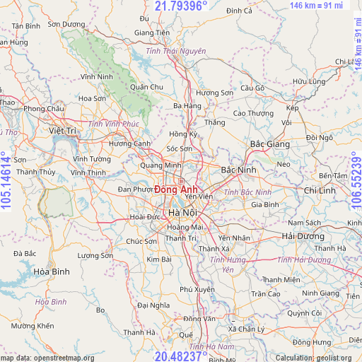
Đông Anh GPS coordinates[2]
21° 8' 22.632" North, 105° 50' 57.336" East
| Map corner | latitude | longitude |
|---|---|---|
| Upper-left | 21.79396°, | 105.14614° |
| Center: | 21.13962°, | 105.84926° |
| Lower-right: | 20.48237°, | 106.55239° |
| Map W x H: | 145.8×145.8 km | = 90.6×90.6mi |
| max Lat: | 23.27841° ⇑21.9% North |
| Đông Anh: | 21.13962° |
| min Lat: | ⇓78.1% South 8.65724° |
| min Long | Đông Anh | max Long |
| 102.4579° | 105.84926° | 112.72541° |
| W 38.8%⇐ | ⇒61.2% E |
Elevation
Elevation of Đông Anh is 15 m = 49 ft, and this is 114.5 m = 376 ft below average elevation for this country.
| Max E: |
1592 m = 5223 ft | 48.5% |
| Avg. | 129.5 m = 425 ft | |
| Đông Anh | 15 m = 49 ft | |
Min E: |
-1 m = -3 ft | 51.5% |
See also: Vietnam elevation on elevation.city.
Geographical zone
Đông Anh is located in North Torrid zone (between Equator and Tropic of Cancer). Distance of this Northern Tropic circle is 255.4 km =158.7 mi to North.| Distance of | km | miles | from Đông Anh |
|---|---|---|---|
| North Pole | 7656.6 | 4757.6 | to North |
| Arctic Circle | 5050.7 | 3138.4 | to North |
| Tropic Cancer | 255.4 | 158.7 | to North |
| Equator | 2350.5 | 1460.5 | to South |


Nearby cities:
15 places around Đông Anh: (largest is in red/bold)
• Chờ
12.5 km =7.8 mi,  60°
60°
• Cầu Diễn
14.1 km =8.8 mi,  217°
217°
• Cầu Giấy
13 km =8.1 mi,  202°
202°
• Hai BàTrưng
14 km =8.7 mi,  180°
180°
• Hanoi
12.8 km =8 mi, 183°
• Hoàn Kiếm
12.3 km =7.6 mi, 179°
• Lim
17.7 km =11 mi,  88°
88°
• Mê Linh
14.2 km =8.8 mi,  289°
289°
• Phù Ninh
12.2 km =7.6 mi,  120°
120°
• Sóc Sơn
13.1 km =8.1 mi,  359°
359°
• Thanh Xuân
16.9 km =10.5 mi, 197°
• Trâu Quỳ
16.2 km =10.1 mi,  145°
145°
• Trôi
16.7 km =10.4 mi,  242°
242°
• Tây Hồ
8.8 km =5.5 mi,  207°
207°
• Đống Đa
13.4 km =8.3 mi,  188°
188°
Sources, notices
• [Note1] Compared only with cities in Vietnam existing in our database
• [Src1] Map data: © OpenStreetMap contributors (CC-BY-SA)
• [Src2] Other city data from geonames.org with taken over terms of usage.
• [Src3] Geographical zone / Annual Mean Temperature by Robert A. Rohde @ Wikipedia
