Tân Thạnh geodata
Tân Thạnh (Long An) is a seat of a second-order administrative division; located in Vietnam in Asia/Ho_Chi_Minh (GMT+7) time zone. In our database, there are 94 cities with bigger population. Compared to other cities in Vietnam, 81.9% of cities are located further ↑North; 52.9% of cities are located further →East and 92.5% of cities have higher elevation than Tân Thạnh. Note1


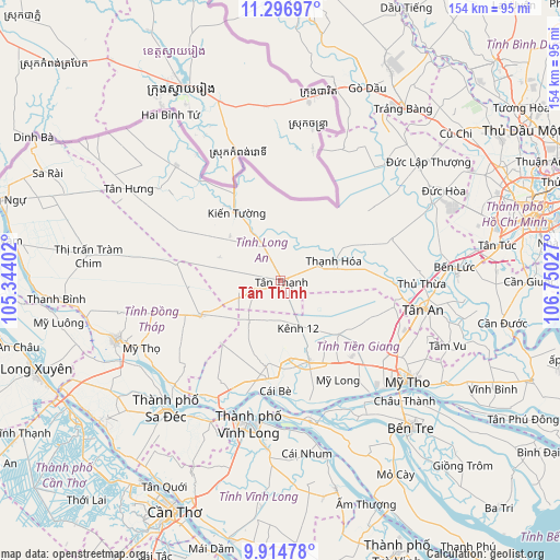
Tân Thạnh GPS coordinates[2]
10° 36' 23.976" North, 106° 2' 49.704" East
| Map corner | latitude | longitude |
|---|---|---|
| Upper-left | 11.29697°, | 105.34402° |
| Center: | 10.60666°, | 106.04714° |
| Lower-right: | 9.91478°, | 106.75027° |
| Map W x H: | 153.7×153.7 km | = 95.5×95.5mi |
| max Lat: | 23.27841° ⇑81.9% North |
| Tân Thạnh: | 10.60666° |
| min Lat: | ⇓18.1% South 8.65724° |
| min Long | Tân Thạnh | max Long |
| 102.4579° | 106.04714° | 112.72541° |
| W 47.1%⇐ | ⇒52.9% E |
Elevation
Elevation of Tân Thạnh is 4 m = 13 ft, and this is 125.5 m = 412 ft below average elevation for this country.
| Max E: |
1592 m = 5223 ft | 92.5% |
| Avg. | 129.5 m = 425 ft | |
| Tân Thạnh | 4 m = 13 ft | |
Min E: |
-1 m = -3 ft | 7.5% |
See also: Vietnam elevation on elevation.city.
Geographical zone
Tân Thạnh is located in North Torrid zone (between Equator and Tropic of Cancer). Distance of Equator is 1179.4 km =732.8 mi to South.| Distance of | km | miles | from Tân Thạnh |
|---|---|---|---|
| North Pole | 8827.7 | 5485.3 | to North |
| Arctic Circle | 6221.8 | 3866 | to North |
| Tropic Cancer | 1426.6 | 886.4 | to North |
| Equator | 1179.4 | 732.8 | to South |


Nearby cities:
15 places around Tân Thạnh: (largest is in red/bold)
• An Hòa
47.8 km =29.7 mi,  223°
223°
• Chợ Lách
39.3 km =24.4 mi,  168°
168°
• Cái Tàu Hạ
43.1 km =26.8 mi,  206°
206°
• Long Hồ
46.2 km =28.7 mi,  184°
184°
• Mỹ Phước
21.5 km =13.4 mi,  132°
132°
• Mỹ Tho
43.8 km =27.2 mi, 128°
• Mỹ Thọ
42.6 km =26.5 mi,  244°
244°
• Sa Dec
47.4 km =29.5 mi, 222°
• Thạnh Hóa
15.7 km =9.8 mi,  68°
68°
• Thủ Thừa
38.8 km =24.1 mi,  90°
90°
• Tân An
40.8 km =25.4 mi,  101°
101°
• Tân Hiệp
36.9 km =22.9 mi,  118°
118°
• Vĩnh Hưng
42.6 km =26.5 mi,  317°
317°
• Vĩnh Long
40.1 km =24.9 mi,  191°
191°
• Đông Thành
42.5 km =26.4 mi,  41°
41°
Sources, notices
• [Note1] Compared only with cities in Vietnam existing in our database
• [Src1] Map data: © OpenStreetMap contributors (CC-BY-SA)
• [Src2] Other city data from geonames.org with taken over terms of usage.
• [Src3] Geographical zone / Annual Mean Temperature by Robert A. Rohde @ Wikipedia
