Phong Điền geodata
Phong Điền (Can Tho) is a seat of a second-order administrative division; located in Vietnam in Asia/Ho_Chi_Minh (GMT+7) time zone. In our database, there are 94 cities with bigger population. Compared to other cities in Vietnam, 92.5% of cities are located further ↑North; 69.5% of cities are located further →East and 99.2% of cities have higher elevation than Phong Điền. Note1


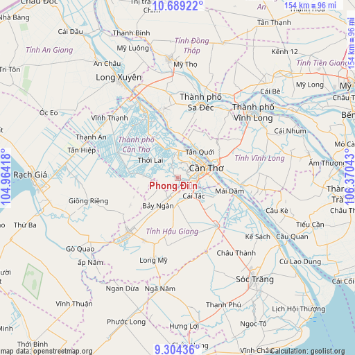
Phong Điền GPS coordinates[2]
9° 59' 51.108" North, 105° 40' 2.28" East
| Map corner | latitude | longitude |
|---|---|---|
| Upper-left | 10.68922°, | 104.96418° |
| Center: | 9.99753°, | 105.6673° |
| Lower-right: | 9.30436°, | 106.37043° |
| Map W x H: | 154×154 km | = 95.7×95.7mi |
| max Lat: | 23.27841° ⇑92.5% North |
| Phong Điền: | 9.99753° |
| min Lat: | ⇓7.5% South 8.65724° |
| min Long | Phong Điền | max Long |
| 102.4579° | 105.6673° | 112.72541° |
| W 30.5%⇐ | ⇒69.5% E |
Elevation
Elevation of Phong Điền is 1 m = 3 ft, and this is 128.5 m = 422 ft below average elevation for this country.
| Max E: |
1592 m = 5223 ft | 99.2% |
| Avg. | 129.5 m = 425 ft | |
| Phong Điền | 1 m = 3 ft | |
Min E: |
-1 m = -3 ft | 0.8% |
See also: Vietnam elevation on elevation.city.
Geographical zone
Phong Điền is located in North Torrid zone (between Equator and Tropic of Cancer). Distance of Equator is 1111.6 km =690.7 mi to South.| Distance of | km | miles | from Phong Điền |
|---|---|---|---|
| North Pole | 8895.4 | 5527.3 | to North |
| Arctic Circle | 6289.6 | 3908.2 | to North |
| Tropic Cancer | 1494.3 | 928.5 | to North |
| Equator | 1111.6 | 690.7 | to South |


Nearby cities:
15 places around Phong Điền: (largest is in red/bold)
• Bình Minh
18.7 km =11.6 mi,  65°
65°
• Bình Thủy
11.7 km =7.3 mi,  42°
42°
• Cái Răng
9.2 km =5.7 mi,  87°
87°
• Cần Thơ
14 km =8.7 mi, 71°
• Cờ Đỏ
28.2 km =17.5 mi,  292°
292°
• Một Ngàn
9.2 km =5.7 mi,  206°
206°
• Ngã Bảy
26.5 km =16.5 mi,  140°
140°
• Ngã Sáu
17.2 km =10.7 mi,  118°
118°
• Nàng Mau
31 km =19.3 mi, 207°
• Phụng Hiệp
25.3 km =15.7 mi,  163°
163°
• Thị Trấn Tân Thành
29.9 km =18.6 mi,  344°
344°
• Thới Lai
14.1 km =8.8 mi,  302°
302°
• Trà Ôn
28.1 km =17.5 mi,  97°
97°
• Vị Thanh
32.1 km =19.9 mi,  222°
222°
• Ô Môn
13.4 km =8.3 mi, 338°
Sources, notices
• [Note1] Compared only with cities in Vietnam existing in our database
• [Src1] Map data: © OpenStreetMap contributors (CC-BY-SA)
• [Src2] Other city data from geonames.org with taken over terms of usage.
• [Src3] Geographical zone / Annual Mean Temperature by Robert A. Rohde @ Wikipedia
