Bình Sơn geodata
Bình Sơn (Quảng Ngãi Province) is a seat of a second-order administrative division; located in Vietnam in Asia/Ho_Chi_Minh (GMT+7) time zone. In our database, there are 94 cities with bigger population. Compared to other cities in Vietnam, 55.6% of cities are located further ↑North; 93.6% of cities are located further ←West and 54.8% of cities have higher elevation than Bình Sơn. Note1


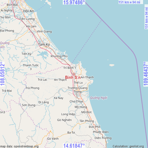
Bình Sơn GPS coordinates[2]
15° 17' 51.936" North, 108° 45' 40.464" East
| Map corner | latitude | longitude |
|---|---|---|
| Upper-left | 15.97486°, | 108.05812° |
| Center: | 15.29776°, | 108.76124° |
| Lower-right: | 14.61847°, | 109.46437° |
| Map W x H: | 150.8×150.8 km | = 93.7×93.7mi |
| max Lat: | 23.27841° ⇑55.6% North |
| Bình Sơn: | 15.29776° |
| min Lat: | ⇓44.4% South 8.65724° |
| min Long | Bình Sơn | max Long |
| 102.4579° | 108.76124° | 112.72541° |
| W 93.6%⇐ | ⇒6.4% E |
Elevation
Elevation of Bình Sơn is 12 m = 39 ft, and this is 117.5 m = 385 ft below average elevation for this country.
| Max E: |
1592 m = 5223 ft | 54.8% |
| Avg. | 129.5 m = 425 ft | |
| Bình Sơn | 12 m = 39 ft | |
Min E: |
-1 m = -3 ft | 45.2% |
See also: Vietnam elevation on elevation.city.
Geographical zone
Bình Sơn is located in North Torrid zone (between Equator and Tropic of Cancer). Distance of this Northern Tropic circle is 905 km =562.3 mi to North.| Distance of | km | miles | from Bình Sơn |
|---|---|---|---|
| North Pole | 8306.1 | 5161.2 | to North |
| Arctic Circle | 5700.2 | 3541.9 | to North |
| Tropic Cancer | 905 | 562.3 | to North |
| Equator | 1701 | 1057 | to South |


Nearby cities:
15 places around Bình Sơn: (largest is in red/bold)
• Lý Sơn
39.2 km =24.4 mi,  77°
77°
• Minh Long
41.1 km =25.5 mi,  188°
188°
• Mộ Đức
40.4 km =25.1 mi,  160°
160°
• Nghĩa Hành
28.1 km =17.5 mi,  176°
176°
• Núi Thành
18.5 km =11.5 mi,  323°
323°
• Pho Duc
57.9 km =36 mi, 158°
• Phú Ninh
47.1 km =29.3 mi,  307°
307°
• Quảng Ngãi
20 km =12.4 mi,  170°
170°
• Sơn Hà
42.3 km =26.3 mi,  227°
227°
• Sơn Tịnh
15.9 km =9.9 mi, 166°
• Tam Kỳ
43.5 km =27 mi, 314°
• Tiên Phước
53.1 km =33 mi,  293°
293°
• Trà Bồng
26.6 km =16.5 mi,  259°
259°
• Tây Trà
45.3 km =28.1 mi,  251°
251°
• Tư Nghĩa
24.7 km =15.3 mi, 163°
Sources, notices
• [Note1] Compared only with cities in Vietnam existing in our database
• [Src1] Map data: © OpenStreetMap contributors (CC-BY-SA)
• [Src2] Other city data from geonames.org with taken over terms of usage.
• [Src3] Geographical zone / Annual Mean Temperature by Robert A. Rohde @ Wikipedia
