Ái Tử geodata
Ái Tử (Quảng Trị) is a seat of a second-order administrative division; located in Vietnam in Asia/Ho_Chi_Minh (GMT+7) time zone. In our database, there are 94 cities with bigger population. Compared to other cities in Vietnam, 50.2% of cities are located further ↓South; 76.2% of cities are located further ←West and 50.4% of cities have higher elevation than Ái Tử. Note1


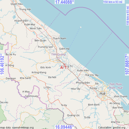
Ái Tử GPS coordinates[2]
16° 46' 7.896" North, 107° 9' 54.144" East
| Map corner | latitude | longitude |
|---|---|---|
| Upper-left | 17.44088°, | 106.46192° |
| Center: | 16.76886°, | 107.16504° |
| Lower-right: | 16.09446°, | 107.86817° |
| Map W x H: | 149.7×149.7 km | = 93×93mi |
| max Lat: | 23.27841° ⇑49.8% North |
| Ái Tử: | 16.76886° |
| min Lat: | ⇓50.2% South 8.65724° |
| min Long | Ái Tử | max Long |
| 102.4579° | 107.16504° | 112.72541° |
| W 76.2%⇐ | ⇒23.8% E |
Elevation
Elevation of Ái Tử is 14 m = 46 ft, and this is 115.5 m = 379 ft below average elevation for this country.
| Max E: |
1592 m = 5223 ft | 50.4% |
| Avg. | 129.5 m = 425 ft | |
| Ái Tử | 14 m = 46 ft | |
Min E: |
-1 m = -3 ft | 49.6% |
See also: Vietnam elevation on elevation.city.
Geographical zone
Ái Tử is located in North Torrid zone (between Equator and Tropic of Cancer). Distance of this Northern Tropic circle is 741.4 km =460.7 mi to North.| Distance of | km | miles | from Ái Tử |
|---|---|---|---|
| North Pole | 8142.5 | 5059.5 | to North |
| Arctic Circle | 5536.7 | 3440.3 | to North |
| Tropic Cancer | 741.4 | 460.7 | to North |
| Equator | 1864.5 | 1158.5 | to South |


Nearby cities:
15 places around Ái Tử: (largest is in red/bold)
• A Lưới
55.7 km =34.6 mi,  172°
172°
• Cam Lộ
18.7 km =11.6 mi,  283°
283°
• Gio Linh
19.3 km =12 mi,  333°
333°
• Huế
57.2 km =35.5 mi,  126°
126°
• Hương Trà
42.7 km =26.5 mi, 129°
• Hải Lăng
12.4 km =7.7 mi, 132°
• Hồ Xá
37.4 km =23.2 mi, 332°
• Khe Sanh
48 km =29.8 mi,  250°
250°
• Khe Tre
89 km =55.3 mi,  138°
138°
• Kiến Giang
64.4 km =40 mi,  321°
321°
• Krông Klang
30.9 km =19.2 mi, 253°
• Phong Điền
29.6 km =18.4 mi, 134°
• Phú Vang
69.1 km =42.9 mi,  122°
122°
• Sịa
42.7 km =26.5 mi, 120°
• Ðông Hà
8.7 km =5.4 mi,  307°
307°
Sources, notices
• [Note1] Compared only with cities in Vietnam existing in our database
• [Src1] Map data: © OpenStreetMap contributors (CC-BY-SA)
• [Src2] Other city data from geonames.org with taken over terms of usage.
• [Src3] Geographical zone / Annual Mean Temperature by Robert A. Rohde @ Wikipedia
