Khe Sanh geodata
Khe Sanh (Quảng Trị) is a seat of a second-order administrative division; located in Vietnam in Asia/Ho_Chi_Minh (GMT+7) time zone. In our database, there are 94 cities with bigger population. Compared to other cities in Vietnam, 50.4% of cities are located further ↑North; 70.3% of cities are located further ←West and 87.1% of cities have lower elevation than Khe Sanh. Note1


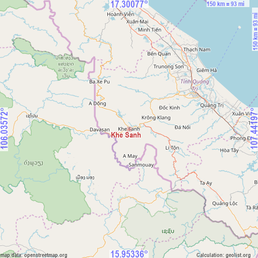
Khe Sanh GPS coordinates[2]
16° 37' 41.7" North, 106° 44' 19.824" East
| Map corner | latitude | longitude |
|---|---|---|
| Upper-left | 17.30077°, | 106.03572° |
| Center: | 16.62825°, | 106.73884° |
| Lower-right: | 15.95336°, | 107.44197° |
| Map W x H: | 149.8×149.8 km | = 93.1×93.1mi |
| max Lat: | 23.27841° ⇑50.4% North |
| Khe Sanh: | 16.62825° |
| min Lat: | ⇓49.6% South 8.65724° |
| min Long | Khe Sanh | max Long |
| 102.4579° | 106.73884° | 112.72541° |
| W 70.3%⇐ | ⇒29.7% E |
Elevation
Elevation of Khe Sanh is 410 m = 1345 ft, and this is 280.5 m = 920 ft above average elevation for this country.
| Max E: |
1592 m = 5223 ft | 12.9% |
| Khe Sanh | 410 m 1345 ft | |
| Avg. | 129.5 m = 425 ft | |
Min E: |
-1 m = -3 ft | 87.1% |
See also: Vietnam elevation on elevation.city.
Geographical zone
Khe Sanh is located in North Torrid zone (between Equator and Tropic of Cancer). Distance of this Northern Tropic circle is 757 km =470.4 mi to North.| Distance of | km | miles | from Khe Sanh |
|---|---|---|---|
| North Pole | 8158.2 | 5069.3 | to North |
| Arctic Circle | 5552.3 | 3450 | to North |
| Tropic Cancer | 757 | 470.4 | to North |
| Equator | 1848.9 | 1148.9 | to South |


Nearby cities:
15 places around Khe Sanh: (largest is in red/bold)
• A Lưới
66 km =41 mi,  126°
126°
• Cam Lộ
33.7 km =20.9 mi,  53°
53°
• Gio Linh
49.4 km =30.7 mi, 48°
• Huế
93.2 km =57.9 mi,  101°
101°
• Hương Trà
79.3 km =49.3 mi, 98°
• Hải Lăng
55.1 km =34.2 mi,  82°
82°
• Hồ Xá
56.6 km =35.2 mi,  30°
30°
• Kiến Giang
66.4 km =41.3 mi,  4°
4°
• Krông Klang
17.2 km =10.7 mi,  66°
66°
• Kwang Binh
94.3 km =58.6 mi,  352°
352°
• Phong Điền
66.8 km =41.5 mi,  94°
94°
• Quán Hàu
86.9 km =54 mi, 353°
• Sịa
82.5 km =51.3 mi, 94°
• Ái Tử
48 km =29.8 mi, 70°
• Ðông Hà
43.8 km =27.2 mi,  61°
61°
Sources, notices
• [Note1] Compared only with cities in Vietnam existing in our database
• [Src1] Map data: © OpenStreetMap contributors (CC-BY-SA)
• [Src2] Other city data from geonames.org with taken over terms of usage.
• [Src3] Geographical zone / Annual Mean Temperature by Robert A. Rohde @ Wikipedia
