Tây Ninh geodata
Tây Ninh (Tây Ninh Province) is a seat of a first-order administrative division; located in Vietnam in Asia/Ho_Chi_Minh (GMT+7) time zone. With population of 36,456 people, there are 69 cities with bigger population in this country. Compared to other cities in Vietnam, 72.1% of cities are located further ↑North; 50.9% of cities are located further →East and 55.8% of cities have lower elevation than Tây Ninh. Note1


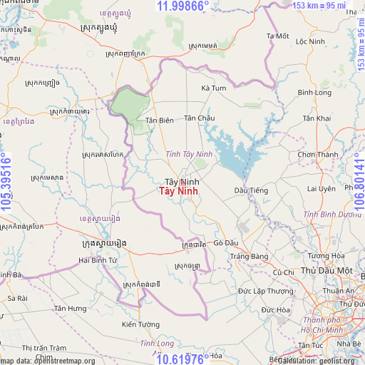
Tây Ninh GPS coordinates[2]
11° 18' 36.144" North, 106° 5' 53.808" East
| Map corner | latitude | longitude |
|---|---|---|
| Upper-left | 11.99866°, | 105.39516° |
| Center: | 11.31004°, | 106.09828° |
| Lower-right: | 10.61976°, | 106.80141° |
| Map W x H: | 153.3×153.3 km | = 95.3×95.3mi |
| max Lat: | 23.27841° ⇑72.1% North |
| Tây Ninh: | 11.31004° |
| min Lat: | ⇓27.9% South 8.65724° |
| min Long | Tây Ninh | max Long |
| 102.4579° | 106.09828° | 112.72541° |
| W 49.1%⇐ | ⇒50.9% E |
Elevation
Elevation of Tây Ninh is 18 m = 59 ft, and this is 111.5 m = 366 ft below average elevation for this country.
| Max E: |
1592 m = 5223 ft | 44.2% |
| Avg. | 129.5 m = 425 ft | |
| Tây Ninh | 18 m = 59 ft | |
Min E: |
-1 m = -3 ft | 55.8% |
See also: Vietnam elevation on elevation.city.
Geographical zone
Tây Ninh is located in North Torrid zone (between Equator and Tropic of Cancer). Distance of Equator is 1257.6 km =781.4 mi to South.| Distance of | km | miles | from Tây Ninh |
|---|---|---|---|
| North Pole | 8749.5 | 5436.7 | to North |
| Arctic Circle | 6143.6 | 3817.5 | to North |
| Tropic Cancer | 1348.4 | 837.9 | to North |
| Equator | 1257.6 | 781.4 | to South |


Nearby cities:
15 places around Tây Ninh: (largest is in red/bold)
• Bến Cầu
23.9 km =14.9 mi,  158°
158°
• Châu Thành
7.5 km =4.7 mi,  271°
271°
• Chơn Thành
60 km =37.3 mi,  77°
77°
• Củ Chi
57.1 km =35.5 mi,  130°
130°
• Dương Minh Châu
16.6 km =10.3 mi,  60°
60°
• Dầu Tiếng
28.7 km =17.8 mi,  98°
98°
• Gò Dầu
30.5 km =19 mi,  143°
143°
• Hòa Thành
4.3 km =2.7 mi, 127°
• Hậu Nghĩa
56.6 km =35.2 mi, 144°
• Phú Khương
4.8 km =3 mi, 127°
• Trảng Bàng
42.1 km =26.2 mi, 137°
• Tân Biên
27.7 km =17.2 mi,  340°
340°
• Tân Châu
28.1 km =17.5 mi,  16°
16°
• Vĩnh Hưng
57.8 km =35.9 mi,  216°
216°
• Đông Thành
51.7 km =32.1 mi,  153°
153°
Sources, notices
• [Note1] Compared only with cities in Vietnam existing in our database
• [Src1] Map data: © OpenStreetMap contributors (CC-BY-SA)
• [Src2] Other city data from geonames.org with taken over terms of usage.
• [Src3] Geographical zone / Annual Mean Temperature by Robert A. Rohde @ Wikipedia
