Tân Châu geodata
Tân Châu (Tây Ninh Province) is a seat of a second-order administrative division; located in Vietnam in Asia/Ho_Chi_Minh (GMT+7) time zone. In our database, there are 94 cities with bigger population. Compared to other cities in Vietnam, 70.3% of cities are located further ↑North; 51.7% of cities are located further ←West and 62% of cities have lower elevation than Tân Châu. Note1


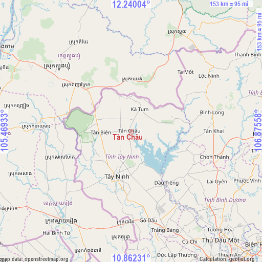
Tân Châu GPS coordinates[2]
11° 33' 7.272" North, 106° 10' 20.82" East
| Map corner | latitude | longitude |
|---|---|---|
| Upper-left | 12.24004°, | 105.46933° |
| Center: | 11.55202°, | 106.17245° |
| Lower-right: | 10.86231°, | 106.87558° |
| Map W x H: | 153.2×153.2 km | = 95.2×95.2mi |
| max Lat: | 23.27841° ⇑70.3% North |
| Tân Châu: | 11.55202° |
| min Lat: | ⇓29.7% South 8.65724° |
| min Long | Tân Châu | max Long |
| 102.4579° | 106.17245° | 112.72541° |
| W 51.7%⇐ | ⇒48.3% E |
Elevation
Elevation of Tân Châu is 27 m = 89 ft, and this is 102.5 m = 336 ft below average elevation for this country.
| Max E: |
1592 m = 5223 ft | 38% |
| Avg. | 129.5 m = 425 ft | |
| Tân Châu | 27 m = 89 ft | |
Min E: |
-1 m = -3 ft | 62% |
See also: Vietnam elevation on elevation.city.
Geographical zone
Tân Châu is located in North Torrid zone (between Equator and Tropic of Cancer). Distance of Equator is 1284.5 km =798.2 mi to South.| Distance of | km | miles | from Tân Châu |
|---|---|---|---|
| North Pole | 8722.6 | 5420 | to North |
| Arctic Circle | 6116.7 | 3800.7 | to North |
| Tropic Cancer | 1321.5 | 821.1 | to North |
| Equator | 1284.5 | 798.2 | to South |


Nearby cities:
15 places around Tân Châu: (largest is in red/bold)
• Bình Long
48.4 km =30.1 mi,  77°
77°
• Bến Cầu
49.1 km =30.5 mi,  179°
179°
• Châu Thành
30.9 km =19.2 mi,  210°
210°
• Chơn Thành
52.3 km =32.5 mi,  105°
105°
• Củ Chi
73.2 km =45.5 mi,  151°
151°
• Dương Minh Châu
19.7 km =12.2 mi,  161°
161°
• Dầu Tiếng
37 km =23 mi, 146°
• Gò Dầu
52.5 km =32.6 mi,  169°
169°
• Hòa Thành
29.8 km =18.5 mi,  189°
189°
• Lộc Ninh
56 km =34.8 mi,  54°
54°
• Phú Khương
30.2 km =18.8 mi, 188°
• Trảng Bàng
61.5 km =38.2 mi, 160°
• Tân Biên
17.5 km =10.9 mi,  267°
267°
• Tây Ninh
28.1 km =17.5 mi,  196°
196°
• Đông Thành
74.8 km =46.5 mi, 168°
Sources, notices
• [Note1] Compared only with cities in Vietnam existing in our database
• [Src1] Map data: © OpenStreetMap contributors (CC-BY-SA)
• [Src2] Other city data from geonames.org with taken over terms of usage.
• [Src3] Geographical zone / Annual Mean Temperature by Robert A. Rohde @ Wikipedia
