Dầu Tiếng geodata
Dầu Tiếng (Bình Dương) is a seat of a second-order administrative division; located in Vietnam in Asia/Ho_Chi_Minh (GMT+7) time zone. In our database, there are 94 cities with bigger population. Compared to other cities in Vietnam, 72.6% of cities are located further ↑North; 58.9% of cities are located further ←West and 58.4% of cities have lower elevation than Dầu Tiếng. Note1


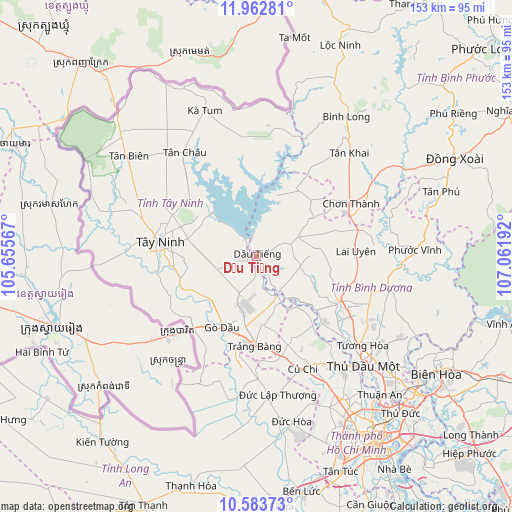
Dầu Tiếng GPS coordinates[2]
11° 16' 26.76" North, 106° 21' 31.644" East
| Map corner | latitude | longitude |
|---|---|---|
| Upper-left | 11.96281°, | 105.65567° |
| Center: | 11.2741°, | 106.35879° |
| Lower-right: | 10.58373°, | 107.06192° |
| Map W x H: | 153.3×153.3 km | = 95.3×95.3mi |
| max Lat: | 23.27841° ⇑72.6% North |
| Dầu Tiếng: | 11.2741° |
| min Lat: | ⇓27.4% South 8.65724° |
| min Long | Dầu Tiếng | max Long |
| 102.4579° | 106.35879° | 112.72541° |
| W 58.9%⇐ | ⇒41.1% E |
Elevation
Elevation of Dầu Tiếng is 21 m = 69 ft, and this is 108.5 m = 356 ft below average elevation for this country.
| Max E: |
1592 m = 5223 ft | 41.6% |
| Avg. | 129.5 m = 425 ft | |
| Dầu Tiếng | 21 m = 69 ft | |
Min E: |
-1 m = -3 ft | 58.4% |
See also: Vietnam elevation on elevation.city.
Geographical zone
Dầu Tiếng is located in North Torrid zone (between Equator and Tropic of Cancer). Distance of Equator is 1253.6 km =779 mi to South.| Distance of | km | miles | from Dầu Tiếng |
|---|---|---|---|
| North Pole | 8753.5 | 5439.2 | to North |
| Arctic Circle | 6147.6 | 3819.9 | to North |
| Tropic Cancer | 1352.4 | 840.3 | to North |
| Equator | 1253.6 | 779 | to South |


Nearby cities:
15 places around Dầu Tiếng: (largest is in red/bold)
• Bến Cầu
26.7 km =16.6 mi,  227°
227°
• Châu Thành
36.1 km =22.4 mi,  276°
276°
• Chơn Thành
34.7 km =21.6 mi,  60°
60°
• Củ Chi
36.5 km =22.7 mi,  156°
156°
• Dương Minh Châu
18.6 km =11.6 mi,  311°
311°
• Gò Dầu
23.1 km =14.4 mi,  206°
206°
• Hòa Thành
25.1 km =15.6 mi,  273°
273°
• Hậu Nghĩa
42.4 km =26.3 mi,  174°
174°
• Phú Khương
24.6 km =15.3 mi, 272°
• Thủ Dầu Một
45.7 km =28.4 mi,  135°
135°
• Trảng Bàng
27.2 km =16.9 mi,  180°
180°
• Tân Biên
48.3 km =30 mi, 308°
• Tân Châu
37 km =23 mi,  326°
326°
• Tây Ninh
28.7 km =17.8 mi, 278°
• Đông Thành
42.8 km =26.6 mi,  187°
187°
Sources, notices
• [Note1] Compared only with cities in Vietnam existing in our database
• [Src1] Map data: © OpenStreetMap contributors (CC-BY-SA)
• [Src2] Other city data from geonames.org with taken over terms of usage.
• [Src3] Geographical zone / Annual Mean Temperature by Robert A. Rohde @ Wikipedia
