Nhơn Trạch geodata
Nhơn Trạch (Đồng Nai) is a seat of a second-order administrative division; located in Vietnam in Asia/Ho_Chi_Minh (GMT+7) time zone. In our database, there are 94 cities with bigger population. Compared to other cities in Vietnam, 80.1% of cities are located further ↑North; 73.1% of cities are located further ←West and 61.8% of cities have lower elevation than Nhơn Trạch. Note1


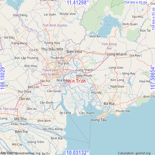
Nhơn Trạch GPS coordinates[2]
10° 43' 22.584" North, 106° 53' 0.276" East
| Map corner | latitude | longitude |
|---|---|---|
| Upper-left | 11.41298°, | 106.18029° |
| Center: | 10.72294°, | 106.88341° |
| Lower-right: | 10.03132°, | 107.58654° |
| Map W x H: | 153.6×153.6 km | = 95.4×95.4mi |
| max Lat: | 23.27841° ⇑80.1% North |
| Nhơn Trạch: | 10.72294° |
| min Lat: | ⇓19.9% South 8.65724° |
| min Long | Nhơn Trạch | max Long |
| 102.4579° | 106.88341° | 112.72541° |
| W 73.1%⇐ | ⇒26.9% E |
Elevation
Elevation of Nhơn Trạch is 26 m = 85 ft, and this is 103.5 m = 340 ft below average elevation for this country.
| Max E: |
1592 m = 5223 ft | 38.2% |
| Avg. | 129.5 m = 425 ft | |
| Nhơn Trạch | 26 m = 85 ft | |
Min E: |
-1 m = -3 ft | 61.8% |
See also: Vietnam elevation on elevation.city.
Geographical zone
Nhơn Trạch is located in North Torrid zone (between Equator and Tropic of Cancer). Distance of Equator is 1192.3 km =740.9 mi to South.| Distance of | km | miles | from Nhơn Trạch |
|---|---|---|---|
| North Pole | 8814.8 | 5477.3 | to North |
| Arctic Circle | 6208.9 | 3858 | to North |
| Tropic Cancer | 1413.6 | 878.4 | to North |
| Equator | 1192.3 | 740.9 | to South |


Nearby cities:
15 places around Nhơn Trạch: (largest is in red/bold)
• Dĩ An
23.9 km =14.9 mi,  328°
328°
• Long Thành
10.4 km =6.5 mi,  44°
44°
• Nhà Bè
15.9 km =9.9 mi,  259°
259°
• Quận Ba
22.3 km =13.9 mi,  285°
285°
• Quận Bình Thạnh
22.3 km =13.9 mi, 293°
• Quận Bảy
16.1 km =10 mi,  265°
265°
• Quận Bốn
20 km =12.4 mi,  284°
284°
• Quận Chín
17.9 km =11.1 mi,  316°
316°
• Quận Hai
16.5 km =10.3 mi,  297°
297°
• Quận Mười
24.2 km =15 mi, 281°
• Quận Một
21.1 km =13.1 mi, 287°
• Quận Năm
23.9 km =14.9 mi, 278°
• Quận Phú Nhuận
24 km =14.9 mi, 289°
• Thị Trấn Phú Mỹ
22.9 km =14.2 mi,  125°
125°
• Thủ Đức
18.5 km =11.5 mi, 318°
Sources, notices
• [Note1] Compared only with cities in Vietnam existing in our database
• [Src1] Map data: © OpenStreetMap contributors (CC-BY-SA)
• [Src2] Other city data from geonames.org with taken over terms of usage.
• [Src3] Geographical zone / Annual Mean Temperature by Robert A. Rohde @ Wikipedia
