Nha Trang geodata
Nha Trang (Khánh Hòa) is a seat of a first-order administrative division; located in Vietnam in Asia/Ho_Chi_Minh (GMT+7) time zone. With population of 283,441 people, there are 6 cities with bigger population in this country. Compared to other cities in Vietnam, 66.9% of cities are located further ↑North; 99% of cities are located further ←West and 61.7% of cities have higher elevation than Nha Trang. Note1


Nha Trang GPS coordinates[2]
12° 14' 42.252" North, 109° 11' 39.552" East
| Map corner | latitude | longitude |
|---|---|---|
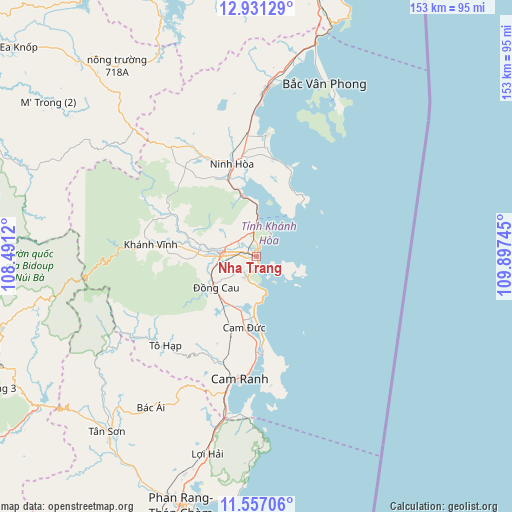
| Upper-left | 12.93129°, | 108.4912° |
| Center: | 12.24507°, | 109.19432° |
| Lower-right: | 11.55706°, | 109.89745° |
| Map W x H: | 152.8×152.8 km | = 94.9×94.9mi |
| max Lat: | 23.27841° ⇑66.9% North |
| Nha Trang: | 12.24507° |
| min Lat: | ⇓33.1% South 8.65724° |
| min Long | Nha Trang | max Long |
| 102.4579° | 109.19432° | 112.72541° |
| W 99%⇐ | ⇒1% E |
Elevation
Elevation of Nha Trang is 10 m = 33 ft, and this is 119.5 m = 392 ft below average elevation for this country.
| Max E: |
1592 m = 5223 ft | 61.7% |
| Avg. | 129.5 m = 425 ft | |
| Nha Trang | 10 m = 33 ft | |
Min E: |
-1 m = -3 ft | 38.3% |
See also: Nha Trang elevation on elevation.city.
Geographical zone
Nha Trang is located in North Torrid zone (between Equator and Tropic of Cancer). Distance of this Northern Tropic circle is 1244.4 km =773.2 mi to North.| Distance of | km | miles | from Nha Trang |
|---|---|---|---|
| North Pole | 8645.5 | 5372.1 | to North |
| Arctic Circle | 6039.6 | 3752.8 | to North |
| Tropic Cancer | 1244.4 | 773.2 | to North |
| Equator | 1361.5 | 846 | to South |


Nearby cities:
15 places around Nha Trang: (largest is in red/bold)
• Bác Ái
55 km =34.2 mi,  215°
215°
• Cam Lâm
21.6 km =13.4 mi,  189°
189°
• Cam Ranh
36.2 km =22.5 mi, 186°
• Diên Khánh
11 km =6.8 mi,  275°
275°
• Hai Riêng
87.7 km =54.5 mi,  338°
338°
• Khánh Hải
74.6 km =46.4 mi, 192°
• Khánh Vĩnh
31.8 km =19.8 mi, 277°
• M’Đrăk
74.2 km =46.1 mi,  318°
318°
• Ninh Hòa
28.5 km =17.7 mi, 344°
• Phan Rang-Tháp Chàm
78.9 km =49 mi,  196°
196°
• Phước Dân
84.9 km =52.8 mi, 199°
• Tân Sơn
68.7 km =42.7 mi, 220°
• Tô Hạp
37.7 km =23.4 mi,  225°
225°
• Vạn Giã
49.8 km =30.9 mi,  3°
3°
• Ðà Lạt
88.3 km =54.9 mi,  247°
247°
Sources, notices
• [Note1] Compared only with cities in Vietnam existing in our database
• [Src1] Map data: © OpenStreetMap contributors (CC-BY-SA)
• [Src2] Other city data from geonames.org with taken over terms of usage.
• [Src3] Geographical zone / Annual Mean Temperature by Robert A. Rohde @ Wikipedia
