Vạn Giã geodata
Vạn Giã (Khánh Hòa) is a seat of a second-order administrative division; located in Vietnam in Asia/Ho_Chi_Minh (GMT+7) time zone. In our database, there are 94 cities with bigger population. Compared to other cities in Vietnam, 64.9% of cities are located further ↑North; 99.3% of cities are located further ←West and 80.8% of cities have higher elevation than Vạn Giã. Note1


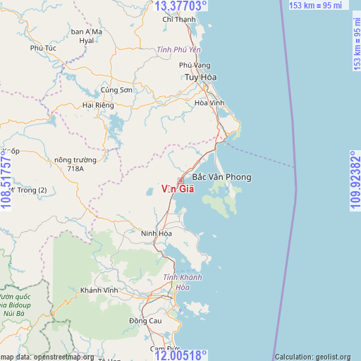
Vạn Giã GPS coordinates[2]
12° 41' 31.308" North, 109° 13' 14.484" East
| Map corner | latitude | longitude |
|---|---|---|
| Upper-left | 13.37703°, | 108.51757° |
| Center: | 12.69203°, | 109.22069° |
| Lower-right: | 12.00518°, | 109.92382° |
| Map W x H: | 152.5×152.5 km | = 94.8×94.8mi |
| max Lat: | 23.27841° ⇑64.9% North |
| Vạn Giã: | 12.69203° |
| min Lat: | ⇓35.1% South 8.65724° |
| min Long | Vạn Giã | max Long |
| 102.4579° | 109.22069° | 112.72541° |
| W 99.3%⇐ | ⇒0.7% E |
Elevation
Elevation of Vạn Giã is 6 m = 20 ft, and this is 123.5 m = 405 ft below average elevation for this country.
| Max E: |
1592 m = 5223 ft | 80.8% |
| Avg. | 129.5 m = 425 ft | |
| Vạn Giã | 6 m = 20 ft | |
Min E: |
-1 m = -3 ft | 19.2% |
See also: Vietnam elevation on elevation.city.
Geographical zone
Vạn Giã is located in North Torrid zone (between Equator and Tropic of Cancer). Distance of this Northern Tropic circle is 1194.7 km =742.4 mi to North.| Distance of | km | miles | from Vạn Giã |
|---|---|---|---|
| North Pole | 8595.8 | 5341.2 | to North |
| Arctic Circle | 5990 | 3722 | to North |
| Tropic Cancer | 1194.7 | 742.4 | to North |
| Equator | 1411.2 | 876.9 | to South |


Nearby cities:
15 places around Vạn Giã: (largest is in red/bold)
• Cam Lâm
71.2 km =44.2 mi,  185°
185°
• Chí Thạnh
68.5 km =42.6 mi,  359°
359°
• Củng Sơn
47.7 km =29.6 mi,  326°
326°
• Diên Khánh
50.5 km =31.4 mi,  195°
195°
• Ea Kar
84.7 km =52.6 mi,  278°
278°
• Hai Riêng
47.4 km =29.5 mi,  312°
312°
• Khánh Vĩnh
56.9 km =35.4 mi,  217°
217°
• La Hai
77.2 km =48 mi,  350°
350°
• M’Đrăk
52.2 km =32.4 mi, 276°
• Nha Trang
49.8 km =30.9 mi,  183°
183°
• Ninh Hòa
24.6 km =15.3 mi,  205°
205°
• Phú Túc
80.3 km =49.9 mi, 314°
• Sông Cầu
84.9 km =52.8 mi,  0°
0°
• Tuy Hòa
46.2 km =28.7 mi,  13°
13°
• Tô Hạp
81.8 km =50.8 mi, 201°
Sources, notices
• [Note1] Compared only with cities in Vietnam existing in our database
• [Src1] Map data: © OpenStreetMap contributors (CC-BY-SA)
• [Src2] Other city data from geonames.org with taken over terms of usage.
• [Src3] Geographical zone / Annual Mean Temperature by Robert A. Rohde @ Wikipedia
