Khánh Vĩnh geodata
Khánh Vĩnh (Khánh Hòa) is a seat of a second-order administrative division; located in Vietnam in Asia/Ho_Chi_Minh (GMT+7) time zone. In our database, there are 94 cities with bigger population. Compared to other cities in Vietnam, 66.4% of cities are located further ↑North; 95.4% of cities are located further ←West and 62.3% of cities have lower elevation than Khánh Vĩnh. Note1


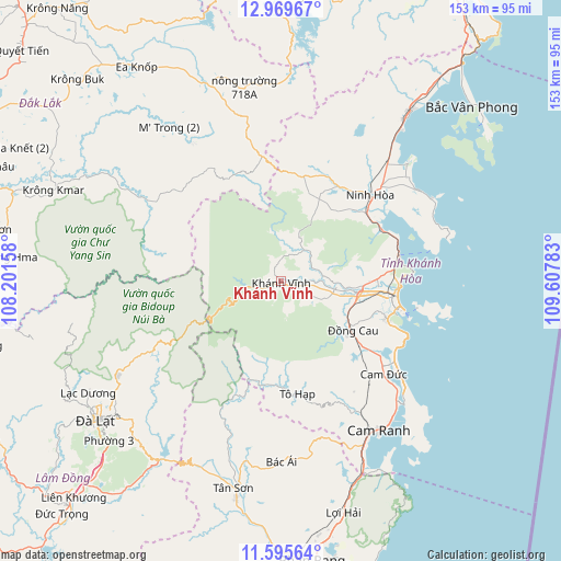
Khánh Vĩnh GPS coordinates[2]
12° 17' 0.78" North, 108° 54' 16.92" East
| Map corner | latitude | longitude |
|---|---|---|
| Upper-left | 12.96967°, | 108.20158° |
| Center: | 12.28355°, | 108.9047° |
| Lower-right: | 11.59564°, | 109.60783° |
| Map W x H: | 152.8×152.8 km | = 94.9×94.9mi |
| max Lat: | 23.27841° ⇑66.4% North |
| Khánh Vĩnh: | 12.28355° |
| min Lat: | ⇓33.6% South 8.65724° |
| min Long | Khánh Vĩnh | max Long |
| 102.4579° | 108.9047° | 112.72541° |
| W 95.4%⇐ | ⇒4.6% E |
Elevation
Elevation of Khánh Vĩnh is 28 m = 92 ft, and this is 101.5 m = 333 ft below average elevation for this country.
| Max E: |
1592 m = 5223 ft | 37.7% |
| Avg. | 129.5 m = 425 ft | |
| Khánh Vĩnh | 28 m = 92 ft | |
Min E: |
-1 m = -3 ft | 62.3% |
See also: Vietnam elevation on elevation.city.
Geographical zone
Khánh Vĩnh is located in North Torrid zone (between Equator and Tropic of Cancer). Distance of this Northern Tropic circle is 1240.1 km =770.6 mi to North.| Distance of | km | miles | from Khánh Vĩnh |
|---|---|---|---|
| North Pole | 8641.3 | 5369.5 | to North |
| Arctic Circle | 6035.4 | 3750.2 | to North |
| Tropic Cancer | 1240.1 | 770.6 | to North |
| Equator | 1365.8 | 848.7 | to South |


Nearby cities:
15 places around Khánh Vĩnh: (largest is in red/bold)
• Bác Ái
49.2 km =30.6 mi,  180°
180°
• Cam Lâm
37.7 km =23.4 mi,  132°
132°
• Cam Ranh
48.8 km =30.3 mi,  145°
145°
• Diên Khánh
20.7 km =12.9 mi,  98°
98°
• Ea Kar
76.5 km =47.5 mi,  319°
319°
• Krông Kmar
66.8 km =41.5 mi,  291°
291°
• Lạc Dương
61.3 km =38.1 mi,  239°
239°
• M’Đrăk
54.4 km =33.8 mi,  341°
341°
• Nha Trang
31.8 km =19.8 mi, 97°
• Ninh Hòa
33.3 km =20.7 mi,  45°
45°
• Thạnh Mỹ
73.2 km =45.5 mi,  217°
217°
• Tân Sơn
58 km =36 mi,  192°
192°
• Tô Hạp
31.2 km =19.4 mi,  171°
171°
• Vạn Giã
56.9 km =35.4 mi,  37°
37°
• Ðà Lạt
62.7 km =39 mi,  233°
233°
Sources, notices
• [Note1] Compared only with cities in Vietnam existing in our database
• [Src1] Map data: © OpenStreetMap contributors (CC-BY-SA)
• [Src2] Other city data from geonames.org with taken over terms of usage.
• [Src3] Geographical zone / Annual Mean Temperature by Robert A. Rohde @ Wikipedia
