Pho Duc geodata
Pho Duc (Quảng Ngãi Province) is a seat of a second-order administrative division; located in Vietnam in Asia/Ho_Chi_Minh (GMT+7) time zone. In our database, there are 94 cities with bigger population. Compared to other cities in Vietnam, 57.4% of cities are located further ↑North; 96.2% of cities are located further ←West and 54.6% of cities have lower elevation than Pho Duc. Note1


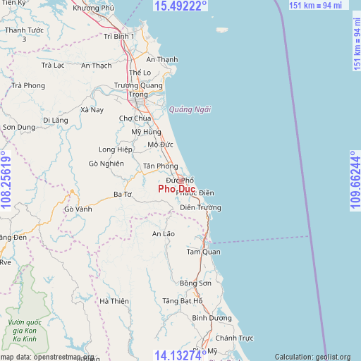
Pho Duc GPS coordinates[2]
14° 48' 48.78" North, 108° 57' 33.516" East
| Map corner | latitude | longitude |
|---|---|---|
| Upper-left | 15.49222°, | 108.25619° |
| Center: | 14.81355°, | 108.95931° |
| Lower-right: | 14.13274°, | 109.66244° |
| Map W x H: | 151.2×151.2 km | = 94×94mi |
| max Lat: | 23.27841° ⇑57.4% North |
| Pho Duc: | 14.81355° |
| min Lat: | ⇓42.6% South 8.65724° |
| min Long | Pho Duc | max Long |
| 102.4579° | 108.95931° | 112.72541° |
| W 96.2%⇐ | ⇒3.8% E |
Elevation
Elevation of Pho Duc is 17 m = 56 ft, and this is 112.5 m = 369 ft below average elevation for this country.
| Max E: |
1592 m = 5223 ft | 45.4% |
| Avg. | 129.5 m = 425 ft | |
| Pho Duc | 17 m = 56 ft | |
Min E: |
-1 m = -3 ft | 54.6% |
See also: Vietnam elevation on elevation.city.
Geographical zone
Pho Duc is located in North Torrid zone (between Equator and Tropic of Cancer). Distance of this Northern Tropic circle is 958.8 km =595.8 mi to North.| Distance of | km | miles | from Pho Duc |
|---|---|---|---|
| North Pole | 8359.9 | 5194.6 | to North |
| Arctic Circle | 5754.1 | 3575.4 | to North |
| Tropic Cancer | 958.8 | 595.8 | to North |
| Equator | 1647.1 | 1023.5 | to South |


Nearby cities:
15 places around Pho Duc: (largest is in red/bold)
• An Lão
23.6 km =14.7 mi,  198°
198°
• Ba Tơ
25 km =15.5 mi,  257°
257°
• Bình Sơn
57.9 km =36 mi,  338°
338°
• Bồng Sơn
43.2 km =26.8 mi,  171°
171°
• Hoài Ân
50 km =31.1 mi,  179°
179°
• Lý Sơn
64.4 km =40 mi,  15°
15°
• Minh Long
30.5 km =19 mi,  295°
295°
• Mộ Đức
17.6 km =10.9 mi,  333°
333°
• Nghĩa Hành
32.4 km =20.1 mi,  322°
322°
• Phù Mỹ
72 km =44.7 mi, 172°
• Quảng Ngãi
38.6 km =24 mi, 332°
• Sơn Hà
58.4 km =36.3 mi, 295°
• Sơn Tịnh
42.2 km =26.2 mi, 335°
• Trà Bồng
68.3 km =42.4 mi, 316°
• Tư Nghĩa
33.4 km =20.8 mi, 334°
Sources, notices
• [Note1] Compared only with cities in Vietnam existing in our database
• [Src1] Map data: © OpenStreetMap contributors (CC-BY-SA)
• [Src2] Other city data from geonames.org with taken over terms of usage.
• [Src3] Geographical zone / Annual Mean Temperature by Robert A. Rohde @ Wikipedia
