An Nhơn geodata
An Nhơn (Bình Định) is a seat of a second-order administrative division; located in Vietnam in Asia/Ho_Chi_Minh (GMT+7) time zone. In our database, there are 94 cities with bigger population. Compared to other cities in Vietnam, 61% of cities are located further ↑North; 98% of cities are located further ←West and 52.4% of cities have higher elevation than An Nhơn. Note1


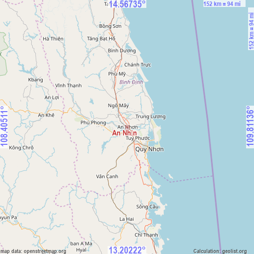
An Nhơn GPS coordinates[2]
13° 53' 8.844" North, 109° 6' 29.628" East
| Map corner | latitude | longitude |
|---|---|---|
| Upper-left | 14.56735°, | 108.40511° |
| Center: | 13.88579°, | 109.10823° |
| Lower-right: | 13.20222°, | 109.81136° |
| Map W x H: | 151.8×151.8 km | = 94.3×94.3mi |
| max Lat: | 23.27841° ⇑61% North |
| An Nhơn: | 13.88579° |
| min Lat: | ⇓39% South 8.65724° |
| min Long | An Nhơn | max Long |
| 102.4579° | 109.10823° | 112.72541° |
| W 98%⇐ | ⇒2% E |
Elevation
Elevation of An Nhơn is 13 m = 43 ft, and this is 116.5 m = 382 ft below average elevation for this country.
| Max E: |
1592 m = 5223 ft | 52.4% |
| Avg. | 129.5 m = 425 ft | |
| An Nhơn | 13 m = 43 ft | |
Min E: |
-1 m = -3 ft | 47.6% |
See also: Vietnam elevation on elevation.city.
Geographical zone
An Nhơn is located in North Torrid zone (between Equator and Tropic of Cancer). Distance of this Northern Tropic circle is 1062 km =659.9 mi to North.| Distance of | km | miles | from An Nhơn |
|---|---|---|---|
| North Pole | 8463.1 | 5258.7 | to North |
| Arctic Circle | 5857.2 | 3639.5 | to North |
| Tropic Cancer | 1062 | 659.9 | to North |
| Equator | 1544 | 959.4 | to South |


Nearby cities:
15 places around An Nhơn: (largest is in red/bold)
• Bồng Sơn
61.2 km =38 mi,  350°
350°
• Chí Thạnh
65.2 km =40.5 mi,  169°
169°
• Hoài Ân
55.3 km =34.4 mi,  343°
343°
• Ia Pa
80.7 km =50.1 mi,  240°
240°
• K Bang
62 km =38.5 mi,  297°
297°
• Kông Chro
64.1 km =39.8 mi,  258°
258°
• La Hai
56.5 km =35.1 mi,  180°
180°
• Phù Cát
14.1 km =8.8 mi, 337°
• Phù Mỹ
32.4 km =20.1 mi, 348°
• Phú Phong
20.6 km =12.8 mi,  277°
277°
• Qui Nhon
17.4 km =10.8 mi,  134°
134°
• Sông Cầu
49.4 km =30.7 mi, 165°
• Tuy Phước
9 km =5.6 mi,  135°
135°
• Vân Canh
31.9 km =19.8 mi,  201°
201°
• Vĩnh Thạnh
42.9 km =26.7 mi,  305°
305°
Sources, notices
• [Note1] Compared only with cities in Vietnam existing in our database
• [Src1] Map data: © OpenStreetMap contributors (CC-BY-SA)
• [Src2] Other city data from geonames.org with taken over terms of usage.
• [Src3] Geographical zone / Annual Mean Temperature by Robert A. Rohde @ Wikipedia
