Yufrus geodata
Yufrus (Ta‘izz) is a seat of a second-order administrative division; located in Yemen in Asia/Aden (GMT+3) time zone. In our database, there are 51 cities with bigger population. Compared to other cities in Yemen, 90.3% of cities are located further ↑North; 67.9% of cities are located further →East and 52.6% of cities have higher elevation than Yufrus. Note1


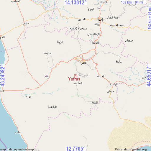
Yufrus GPS coordinates[2]
13° 27' 19.044" North, 43° 56' 49.344" East
| Map corner | latitude | longitude |
|---|---|---|
| Upper-left | 14.13812°, | 43.24392° |
| Center: | 13.45529°, | 43.94704° |
| Lower-right: | 12.7705°, | 44.65017° |
| Map W x H: | 152.1×152.1 km | = 94.5×94.5mi |
| max Lat: | 17.76999° ⇑90.3% North |
| Yufrus: | 13.45529° |
| min Lat: | ⇓9.7% South 12.18576° |
| min Long | Yufrus | max Long |
| 42.67107° | 43.94704° | 54.01895° |
| W 32.1%⇐ | ⇒67.9% E |
Elevation
Elevation of Yufrus is 1261 m = 4137 ft, and this is 43.8 m = 144 ft below average elevation for this country.
| Max E: |
2791 m = 9157 ft | 52.6% |
| Avg. | 1304.8 m = 4281 ft | |
| Yufrus | 1261 m = 4137 ft | |
Min E: |
4 m = 13 ft | 47.4% |
See also: Yemen elevation on elevation.city.
Geographical zone
Yufrus is located in North Torrid zone (between Equator and Tropic of Cancer). Distance of this Northern Tropic circle is 1109.8 km =689.6 mi to North.| Distance of | km | miles | from Yufrus |
|---|---|---|---|
| North Pole | 8511 | 5288.5 | to North |
| Arctic Circle | 5905.1 | 3669.3 | to North |
| Tropic Cancer | 1109.8 | 689.6 | to North |
| Equator | 1496.1 | 929.6 | to South |


Nearby cities:
15 places around Yufrus: (largest is in red/bold)
• Ad Dimnah
25.4 km =15.8 mi,  90°
90°
• Al Masālīyah
10 km =6.2 mi,  31°
31°
• Al Misrākh
8 km =5 mi, 85°
• Al Nashmah
7.6 km =4.7 mi,  162°
162°
• Al ‘Ayn
21 km =13 mi,  131°
131°
• Ar Rawnah
36.9 km =22.9 mi,  335°
335°
• Ar Rubū‘
37.1 km =23.1 mi,  346°
346°
• At Turbah
33.1 km =20.6 mi,  144°
144°
• Aş Şalw
32.4 km =20.1 mi,  115°
115°
• Dār an Nāşir
13.5 km =8.4 mi, 33°
• Maqbanah
36.4 km =22.6 mi,  309°
309°
• Qaryat Al kudshi al Ra'inah
27.4 km =17 mi, 342°
• Ta‘izz
16 km =9.9 mi, 30°
• Ḩawrah
24.1 km =15 mi, 116°
• Ḩayfān
39.1 km =24.3 mi,  112°
112°
Sources, notices
• [Note1] Compared only with cities in Yemen existing in our database
• [Src1] Map data: © OpenStreetMap contributors (CC-BY-SA)
• [Src2] Other city data from geonames.org with taken over terms of usage.
• [Src3] Geographical zone / Annual Mean Temperature by Robert A. Rohde @ Wikipedia
