Ad Dimnah geodata
Ad Dimnah (Ta‘izz) is a seat of a second-order administrative division; located in Yemen in Asia/Aden (GMT+3) time zone. In our database, there are 51 cities with bigger population. Compared to other cities in Yemen, 90.6% of cities are located further ↑North; 57.1% of cities are located further →East and 54.5% of cities have higher elevation than Ad Dimnah. Note1


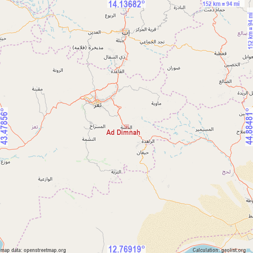
Ad Dimnah GPS coordinates[2]
13° 27' 14.328" North, 44° 10' 54.048" East
| Map corner | latitude | longitude |
|---|---|---|
| Upper-left | 14.13682°, | 43.47856° |
| Center: | 13.45398°, | 44.18168° |
| Lower-right: | 12.76919°, | 44.88481° |
| Map W x H: | 152.1×152.1 km | = 94.5×94.5mi |
| max Lat: | 17.76999° ⇑90.6% North |
| Ad Dimnah: | 13.45398° |
| min Lat: | ⇓9.4% South 12.18576° |
| min Long | Ad Dimnah | max Long |
| 42.67107° | 44.18168° | 54.01895° |
| W 42.9%⇐ | ⇒57.1% E |
Elevation
Elevation of Ad Dimnah is 1236 m = 4055 ft, and this is 68.8 m = 226 ft below average elevation for this country.
| Max E: |
2791 m = 9157 ft | 54.5% |
| Avg. | 1304.8 m = 4281 ft | |
| Ad Dimnah | 1236 m = 4055 ft | |
Min E: |
4 m = 13 ft | 45.5% |
See also: Yemen elevation on elevation.city.
Geographical zone
Ad Dimnah is located in North Torrid zone (between Equator and Tropic of Cancer). Distance of this Northern Tropic circle is 1110 km =689.7 mi to North.| Distance of | km | miles | from Ad Dimnah |
|---|---|---|---|
| North Pole | 8511.1 | 5288.6 | to North |
| Arctic Circle | 5905.2 | 3669.3 | to North |
| Tropic Cancer | 1110 | 689.7 | to North |
| Equator | 1495.9 | 929.5 | to South |


Nearby cities:
15 places around Ad Dimnah: (largest is in red/bold)
• Al Masālīyah
21.9 km =13.6 mi,  293°
293°
• Al Misrākh
17.5 km =10.9 mi,  272°
272°
• Al Nashmah
24.1 km =15 mi,  252°
252°
• Al ‘Ayn
16.8 km =10.4 mi,  215°
215°
• At Turbah
27.5 km =17.1 mi,  193°
193°
• Aş Şalw
14.4 km =8.9 mi,  164°
164°
• Dār an Nāşir
21.3 km =13.2 mi,  302°
302°
• Kirsh
34.8 km =21.6 mi,  106°
106°
• Māwiyah
23 km =14.3 mi,  51°
51°
• Ta‘izz
22.3 km =13.9 mi,  308°
308°
• Yufrus
25.4 km =15.8 mi, 270°
• Ţawr al Bāḩah
32.8 km =20.4 mi, 157°
• Ḩadādah
32.6 km =20.3 mi, 162°
• Ḩawrah
11.4 km =7.1 mi,  199°
199°
• Ḩayfān
18.5 km =11.5 mi,  144°
144°
Sources, notices
• [Note1] Compared only with cities in Yemen existing in our database
• [Src1] Map data: © OpenStreetMap contributors (CC-BY-SA)
• [Src2] Other city data from geonames.org with taken over terms of usage.
• [Src3] Geographical zone / Annual Mean Temperature by Robert A. Rohde @ Wikipedia
