Al Nashmah geodata
Al Nashmah (Ta‘izz) is a seat of a second-order administrative division; located in Yemen in Asia/Aden (GMT+3) time zone. In our database, there are 51 cities with bigger population. Compared to other cities in Yemen, 91.6% of cities are located further ↑North; 66.9% of cities are located further →East and 51.3% of cities have lower elevation than Al Nashmah. Note1


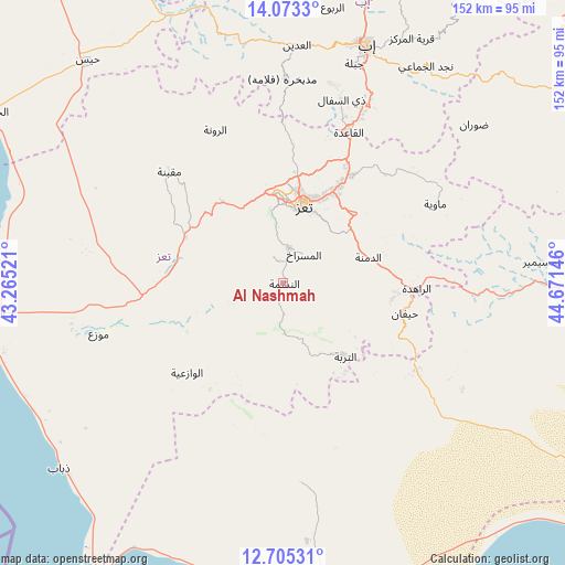
Al Nashmah GPS coordinates[2]
13° 23' 25.008" North, 43° 58' 5.988" East
| Map corner | latitude | longitude |
|---|---|---|
| Upper-left | 14.0733°, | 43.26521° |
| Center: | 13.39028°, | 43.96833° |
| Lower-right: | 12.70531°, | 44.67146° |
| Map W x H: | 152.1×152.1 km | = 94.5×94.5mi |
| max Lat: | 17.76999° ⇑91.6% North |
| Al Nashmah: | 13.39028° |
| min Lat: | ⇓8.4% South 12.18576° |
| min Long | Al Nashmah | max Long |
| 42.67107° | 43.96833° | 54.01895° |
| W 33.1%⇐ | ⇒66.9% E |
Elevation
Elevation of Al Nashmah is 1320 m = 4331 ft, and this is 15.2 m = 50 ft above average elevation for this country.
| Max E: |
2791 m = 9157 ft | 48.7% |
| Al Nashmah | 1320 m 4331 ft | |
| Avg. | 1304.8 m = 4281 ft | |
Min E: |
4 m = 13 ft | 51.3% |
See also: Yemen elevation on elevation.city.
Geographical zone
Al Nashmah is located in North Torrid zone (between Equator and Tropic of Cancer). Distance of this Northern Tropic circle is 1117.1 km =694.1 mi to North.| Distance of | km | miles | from Al Nashmah |
|---|---|---|---|
| North Pole | 8518.2 | 5293 | to North |
| Arctic Circle | 5912.3 | 3673.7 | to North |
| Tropic Cancer | 1117.1 | 694.1 | to North |
| Equator | 1488.9 | 925.2 | to South |


Nearby cities:
15 places around Al Nashmah: (largest is in red/bold)
• Ad Dimnah
24.1 km =15 mi,  72°
72°
• Al Masālīyah
16 km =9.9 mi,  10°
10°
• Al Misrākh
9.6 km =6 mi,  35°
35°
• Al ‘Ayn
15 km =9.3 mi,  116°
116°
• Ash Shuqayrah
34.6 km =21.5 mi,  214°
214°
• At Turbah
26 km =16.2 mi,  139°
139°
• Aş Şalw
27.8 km =17.3 mi,  104°
104°
• Dār an Nāşir
19.2 km =11.9 mi,  15°
15°
• Qaryat Al kudshi al Ra'inah
35 km =21.7 mi,  342°
342°
• Ta‘izz
21.8 km =13.5 mi, 15°
• Yufrus
7.6 km =4.7 mi, 342°
• Ţawr al Bāḩah
42.7 km =26.5 mi, 122°
• Ḩadādah
40.9 km =25.4 mi,  125°
125°
• Ḩawrah
19.5 km =12.1 mi, 100°
• Ḩayfān
34.7 km =21.6 mi, 103°
Sources, notices
• [Note1] Compared only with cities in Yemen existing in our database
• [Src1] Map data: © OpenStreetMap contributors (CC-BY-SA)
• [Src2] Other city data from geonames.org with taken over terms of usage.
• [Src3] Geographical zone / Annual Mean Temperature by Robert A. Rohde @ Wikipedia
