Al Musaymīr geodata
Al Musaymīr (Laḩij) is a seat of a second-order administrative division; located in Yemen in Asia/Aden (GMT+3) time zone. With population of 3 people, there are 49 cities with bigger population in this country. Compared to other cities in Yemen, 90.9% of cities are located further ↑North; 55.8% of cities are located further ←West and 77.6% of cities have higher elevation than Al Musaymīr. Note1


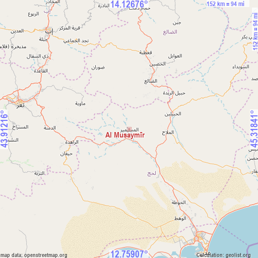
Al Musaymīr GPS coordinates[2]
13° 26' 38.004" North, 44° 36' 55.008" East
| Map corner | latitude | longitude |
|---|---|---|
| Upper-left | 14.12676°, | 43.91216° |
| Center: | 13.44389°, | 44.61528° |
| Lower-right: | 12.75907°, | 45.31841° |
| Map W x H: | 152.1×152.1 km | = 94.5×94.5mi |
| max Lat: | 17.76999° ⇑90.9% North |
| Al Musaymīr: | 13.44389° |
| min Lat: | ⇓9.1% South 12.18576° |
| min Long | Al Musaymīr | max Long |
| 42.67107° | 44.61528° | 54.01895° |
| W 55.8%⇐ | ⇒44.2% E |
Elevation
Elevation of Al Musaymīr is 639 m = 2096 ft, and this is 665.8 m = 2184 ft below average elevation for this country.
| Max E: |
2791 m = 9157 ft | 77.6% |
| Avg. | 1304.8 m = 4281 ft | |
| Al Musaymīr | 639 m = 2096 ft | |
Min E: |
4 m = 13 ft | 22.4% |
See also: Yemen elevation on elevation.city.
Geographical zone
Al Musaymīr is located in North Torrid zone (between Equator and Tropic of Cancer). Distance of this Northern Tropic circle is 1111.1 km =690.4 mi to North.| Distance of | km | miles | from Al Musaymīr |
|---|---|---|---|
| North Pole | 8512.2 | 5289.2 | to North |
| Arctic Circle | 5906.4 | 3670.1 | to North |
| Tropic Cancer | 1111.1 | 690.4 | to North |
| Equator | 1494.8 | 928.8 | to South |


Nearby cities:
15 places around Al Musaymīr: (largest is in red/bold)
• Ad Dimnah
46.9 km =29.1 mi,  271°
271°
• Al Milāḩ
22.8 km =14.2 mi,  94°
94°
• Al Ḩabīlayn
26.8 km =16.7 mi,  71°
71°
• Al Ḩusayn
42.1 km =26.2 mi,  23°
23°
• Aş Şalw
44.9 km =27.9 mi,  253°
253°
• Dhalie
30.7 km =19.1 mi, 24°
• Dhī Jalāl
22.4 km =13.9 mi,  26°
26°
• Kirsh
16.1 km =10 mi,  236°
236°
• Māwiyah
32.8 km =20.4 mi,  298°
298°
• Qa‘ţabah
46.7 km =29 mi,  12°
12°
• Ţawr al Bāḩah
44.9 km =27.9 mi,  229°
229°
• Ḑawrān
41.2 km =25.6 mi,  332°
332°
• Ḩabīl al Jabr
43.8 km =27.2 mi, 66°
• Ḩabīl ar Raydah
33.9 km =21.1 mi,  48°
48°
• Ḩayfān
38.9 km =24.2 mi, 248°
Sources, notices
• [Note1] Compared only with cities in Yemen existing in our database
• [Src1] Map data: © OpenStreetMap contributors (CC-BY-SA)
• [Src2] Other city data from geonames.org with taken over terms of usage.
• [Src3] Geographical zone / Annual Mean Temperature by Robert A. Rohde @ Wikipedia
