Maidi geodata
Maidi (Ḩajjah) is a seat of a second-order administrative division; located in Yemen in Asia/Aden (GMT+3) time zone. In our database, there are 51 cities with bigger population. Compared to other cities in Yemen, 90.6% of cities are located further ↓South; 99.4% of cities are located further →East and 97.7% of cities have higher elevation than Maidi. Note1


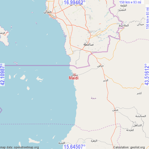
Maidi GPS coordinates[2]
16° 19' 15.636" North, 42° 48' 46.764" East
| Map corner | latitude | longitude |
|---|---|---|
| Upper-left | 16.99462°, | 42.10987° |
| Center: | 16.32101°, | 42.81299° |
| Lower-right: | 15.64507°, | 43.51612° |
| Map W x H: | 150.1×150.1 km | = 93.3×93.3mi |
| max Lat: | 17.76999° ⇑9.4% North |
| Maidi: | 16.32101° |
| min Lat: | ⇓90.6% South 12.18576° |
| min Long | Maidi | max Long |
| 42.67107° | 42.81299° | 54.01895° |
| W 0.6%⇐ | ⇒99.4% E |
Elevation
Elevation of Maidi is 10 m = 33 ft, and this is 1294.8 m = 4248 ft below average elevation for this country.
| Max E: |
2791 m = 9157 ft | 97.7% |
| Avg. | 1304.8 m = 4281 ft | |
| Maidi | 10 m = 33 ft | |
Min E: |
4 m = 13 ft | 2.3% |
See also: Yemen elevation on elevation.city.
Geographical zone
Maidi is located in North Torrid zone (between Equator and Tropic of Cancer). Distance of this Northern Tropic circle is 791.2 km =491.6 mi to North.| Distance of | km | miles | from Maidi |
|---|---|---|---|
| North Pole | 8192.3 | 5090.5 | to North |
| Arctic Circle | 5586.4 | 3471.2 | to North |
| Tropic Cancer | 791.2 | 491.6 | to North |
| Equator | 1814.7 | 1127.6 | to South |


Nearby cities:
15 places around Maidi: (largest is in red/bold)
• Abs
54.2 km =33.7 mi,  130°
130°
• Al Luḩayyah
69.9 km =43.4 mi,  190°
190°
• Al Malāḩīţ
70.1 km =43.6 mi,  44°
44°
• Al Mashāf
72.5 km =45 mi,  34°
34°
• Al Maḩābishah
78.4 km =48.7 mi,  121°
121°
• Al Miftāḩ
79.5 km =49.4 mi, 119°
• Aslam
62.1 km =38.6 mi, 117°
• Az Zuhrah
69.2 km =43 mi,  163°
163°
• Khayrān
69 km =42.9 mi, 118°
• Kushar
67.5 km =41.9 mi,  105°
105°
• Ku‘aydinah
78.9 km =49 mi, 134°
• Mustabā’
47.7 km =29.6 mi,  102°
102°
• Sūq Shamar
76.6 km =47.6 mi, 129°
• Washḩah
63.8 km =39.6 mi,  91°
91°
• Ḩaraḑ
28 km =17.4 mi,  69°
69°
Sources, notices
• [Note1] Compared only with cities in Yemen existing in our database
• [Src1] Map data: © OpenStreetMap contributors (CC-BY-SA)
• [Src2] Other city data from geonames.org with taken over terms of usage.
• [Src3] Geographical zone / Annual Mean Temperature by Robert A. Rohde @ Wikipedia
