Ḩaraḑ geodata
Ḩaraḑ (Ḩajjah) is a seat of a second-order administrative division; located in Yemen in Asia/Aden (GMT+3) time zone. In our database, there are 51 cities with bigger population. Compared to other cities in Yemen, 91.2% of cities are located further ↓South; 97.4% of cities are located further →East and 87.3% of cities have higher elevation than Ḩaraḑ. Note1


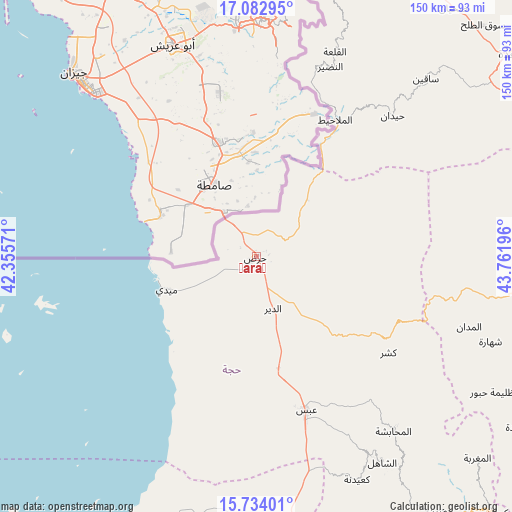
Ḩaraḑ GPS coordinates[2]
16° 24' 34.74" North, 43° 3' 31.788" East
| Map corner | latitude | longitude |
|---|---|---|
| Upper-left | 17.08295°, | 42.35571° |
| Center: | 16.40965°, | 43.05883° |
| Lower-right: | 15.73401°, | 43.76196° |
| Map W x H: | 150×150 km | = 93.2×93.2mi |
| max Lat: | 17.76999° ⇑8.8% North |
| Ḩaraḑ: | 16.40965° |
| min Lat: | ⇓91.2% South 12.18576° |
| min Long | Ḩaraḑ | max Long |
| 42.67107° | 43.05883° | 54.01895° |
| W 2.6%⇐ | ⇒97.4% E |
Elevation
Elevation of Ḩaraḑ is 105 m = 344 ft, and this is 1199.8 m = 3936 ft below average elevation for this country.
| Max E: |
2791 m = 9157 ft | 87.3% |
| Avg. | 1304.8 m = 4281 ft | |
| Ḩaraḑ | 105 m = 344 ft | |
Min E: |
4 m = 13 ft | 12.7% |
See also: Yemen elevation on elevation.city.
Geographical zone
Ḩaraḑ is located in North Torrid zone (between Equator and Tropic of Cancer). Distance of this Northern Tropic circle is 781.3 km =485.5 mi to North.| Distance of | km | miles | from Ḩaraḑ |
|---|---|---|---|
| North Pole | 8182.5 | 5084.4 | to North |
| Arctic Circle | 5576.6 | 3465.1 | to North |
| Tropic Cancer | 781.3 | 485.5 | to North |
| Equator | 1824.6 | 1133.8 | to South |


Nearby cities:
15 places around Ḩaraḑ: (largest is in red/bold)
• Abs
47.6 km =29.6 mi,  161°
161°
• Al Madān
65.7 km =40.8 mi,  108°
108°
• Al Malāḩīţ
46.1 km =28.6 mi,  30°
30°
• Al Mashāf
52 km =32.3 mi,  16°
16°
• Al Maḩābishah
65.3 km =40.6 mi,  141°
141°
• Al Miftāḩ
64.9 km =40.3 mi, 138°
• An Naz̧īr
59.6 km =37 mi, 21°
• Aslam
48.3 km =30 mi, 143°
• Khayrān
55 km =34.2 mi, 141°
• Kushar
47.9 km =29.8 mi,  126°
126°
• Maidi
28 km =17.4 mi,  249°
249°
• Mustabā’
28.6 km =17.8 mi, 134°
• Washḩah
39.2 km =24.4 mi, 106°
• Şuwayr
64 km =39.8 mi, 113°
• Ḩaydān
57.3 km =35.6 mi,  44°
44°
Sources, notices
• [Note1] Compared only with cities in Yemen existing in our database
• [Src1] Map data: © OpenStreetMap contributors (CC-BY-SA)
• [Src2] Other city data from geonames.org with taken over terms of usage.
• [Src3] Geographical zone / Annual Mean Temperature by Robert A. Rohde @ Wikipedia
