Washḩah geodata
Washḩah (Ḩajjah) is a seat of a second-order administrative division; located in Yemen in Asia/Aden (GMT+3) time zone. In our database, there are 51 cities with bigger population. Compared to other cities in Yemen, 89.6% of cities are located further ↓South; 88.6% of cities are located further →East and 56.8% of cities have lower elevation than Washḩah. Note1


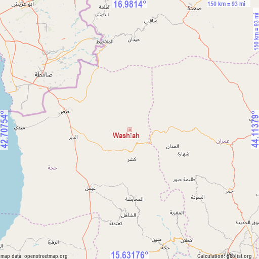
Washḩah GPS coordinates[2]
16° 18' 27.864" North, 43° 24' 38.376" East
| Map corner | latitude | longitude |
|---|---|---|
| Upper-left | 16.9814°, | 42.70754° |
| Center: | 16.30774°, | 43.41066° |
| Lower-right: | 15.63176°, | 44.11379° |
| Map W x H: | 150.1×150.1 km | = 93.3×93.3mi |
| max Lat: | 17.76999° ⇑10.4% North |
| Washḩah: | 16.30774° |
| min Lat: | ⇓89.6% South 12.18576° |
| min Long | Washḩah | max Long |
| 42.67107° | 43.41066° | 54.01895° |
| W 11.4%⇐ | ⇒88.6% E |
Elevation
Elevation of Washḩah is 1514 m = 4967 ft, and this is 209.2 m = 686 ft above average elevation for this country.
| Max E: |
2791 m = 9157 ft | 43.2% |
| Washḩah | 1514 m 4967 ft | |
| Avg. | 1304.8 m = 4281 ft | |
Min E: |
4 m = 13 ft | 56.8% |
See also: Yemen elevation on elevation.city.
Geographical zone
Washḩah is located in North Torrid zone (between Equator and Tropic of Cancer). Distance of this Northern Tropic circle is 792.7 km =492.6 mi to North.| Distance of | km | miles | from Washḩah |
|---|---|---|---|
| North Pole | 8193.8 | 5091.4 | to North |
| Arctic Circle | 5587.9 | 3472.2 | to North |
| Tropic Cancer | 792.7 | 492.6 | to North |
| Equator | 1813.3 | 1126.7 | to South |


Nearby cities:
15 places around Washḩah: (largest is in red/bold)
• Abs
40.8 km =25.4 mi,  213°
213°
• Al Jamīmah
37.8 km =23.5 mi,  148°
148°
• Al Madān
26.6 km =16.5 mi,  110°
110°
• Al Maḩābishah
40.1 km =24.9 mi,  176°
176°
• Al Miftāḩ
37.5 km =23.3 mi,  171°
171°
• Al Qaflah
38.1 km =23.7 mi,  88°
88°
• Aslam
29 km =18 mi,  197°
197°
• Khayrān
32 km =19.9 mi,  186°
186°
• Kushar
17 km =10.6 mi, 176°
• Mustabā’
19.4 km =12.1 mi,  242°
242°
• Shahārat al Ghīs
34 km =21.1 mi, 113°
• Sūq Shamar
47.2 km =29.3 mi, 185°
• Şuwayr
25.5 km =15.8 mi,  123°
123°
• Ḩabūr
42.6 km =26.5 mi,  132°
132°
• Ḩaraḑ
39.2 km =24.4 mi,  286°
286°
Sources, notices
• [Note1] Compared only with cities in Yemen existing in our database
• [Src1] Map data: © OpenStreetMap contributors (CC-BY-SA)
• [Src2] Other city data from geonames.org with taken over terms of usage.
• [Src3] Geographical zone / Annual Mean Temperature by Robert A. Rohde @ Wikipedia
