Jawf al Maqbābah geodata
Jawf al Maqbābah (Abyan) is a populated place; located in Yemen in Asia/Aden (GMT+3) time zone. With population of 14,175 people, there are 24 cities with bigger population in this country. Compared to other cities in Yemen, 81.2% of cities are located further ↑North; 78.2% of cities are located further ←West and 68.5% of cities have higher elevation than Jawf al Maqbābah. Note1


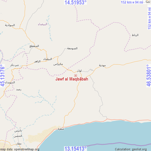
Jawf al Maqbābah GPS coordinates[2]
13° 50' 16.188" North, 45° 50' 5.568" East
| Map corner | latitude | longitude |
|---|---|---|
| Upper-left | 14.51953°, | 45.13176° |
| Center: | 13.83783°, | 45.83488° |
| Lower-right: | 13.15413°, | 46.53801° |
| Map W x H: | 151.8×151.8 km | = 94.3×94.3mi |
| max Lat: | 17.76999° ⇑81.2% North |
| Jawf al Maqbābah: | 13.83783° |
| min Lat: | ⇓18.8% South 12.18576° |
| min Long | Jawf al Maqbāb | max Long |
| 42.67107° | 45.83488° | 54.01895° |
| W 78.2%⇐ | ⇒21.8% E |
Elevation
Elevation of Jawf al Maqbābah is 919 m = 3015 ft, and this is 385.8 m = 1266 ft below average elevation for this country.
| Max E: |
2791 m = 9157 ft | 68.5% |
| Avg. | 1304.8 m = 4281 ft | |
| Jawf al Maqbābah | 919 m = 3015 ft | |
Min E: |
4 m = 13 ft | 31.5% |
See also: Yemen elevation on elevation.city.
Geographical zone
Jawf al Maqbābah is located in North Torrid zone (between Equator and Tropic of Cancer). Distance of this Northern Tropic circle is 1067.3 km =663.2 mi to North.| Distance of | km | miles | from Jawf al Maqbābah |
|---|---|---|---|
| North Pole | 8468.4 | 5262 | to North |
| Arctic Circle | 5862.6 | 3642.8 | to North |
| Tropic Cancer | 1067.3 | 663.2 | to North |
| Equator | 1538.6 | 956 | to South |


Nearby cities:
15 places around Jawf al Maqbābah: (largest is in red/bold)
• Al Bayda
32.7 km =20.3 mi,  300°
300°
• Al Wuday‘
21.1 km =13.1 mi,  110°
110°
• Az Zāhir
40.6 km =25.2 mi,  290°
290°
• Aş Şawma‘ah
27.7 km =17.2 mi,  352°
352°
• Banī Bakr
62.2 km =38.6 mi,  279°
279°
• Dhī Nā‘im
51.3 km =31.9 mi,  305°
305°
• Jayshān
59.2 km =36.8 mi,  38°
38°
• Lawdar
6.2 km =3.9 mi, 36°
• Madīnat Lab‘ūs
63.2 km =39.3 mi,  272°
272°
• Maswarah
57.5 km =35.7 mi, 348°
• Mukayrās
21.3 km =13.2 mi, 303°
• Mūdīyah
28.6 km =17.8 mi,  69°
69°
• Raşad
59.1 km =36.7 mi,  256°
256°
• Sirār
60.5 km =37.6 mi,  248°
248°
• Sūq Sibāḩ
47.9 km =29.8 mi, 266°
Sources, notices
• [Note1] Compared only with cities in Yemen existing in our database
• [Src1] Map data: © OpenStreetMap contributors (CC-BY-SA)
• [Src2] Other city data from geonames.org with taken over terms of usage.
• [Src3] Geographical zone / Annual Mean Temperature by Robert A. Rohde @ Wikipedia
