Aş Şawma‘ah geodata
Aş Şawma‘ah (Al Bayda) is a seat of a second-order administrative division; located in Yemen in Asia/Aden (GMT+3) time zone. In our database, there are 51 cities with bigger population. Compared to other cities in Yemen, 73.4% of cities are located further ↑North; 77.6% of cities are located further ←West and 76.3% of cities have lower elevation than Aş Şawma‘ah. Note1


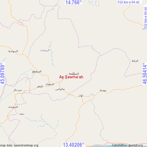
Aş Şawma‘ah GPS coordinates[2]
14° 5' 6.18" North, 45° 48' 3.636" East
| Map corner | latitude | longitude |
|---|---|---|
| Upper-left | 14.766°, | 45.09789° |
| Center: | 14.08505°, | 45.80101° |
| Lower-right: | 13.40206°, | 46.50414° |
| Map W x H: | 151.7×151.7 km | = 94.3×94.3mi |
| max Lat: | 17.76999° ⇑73.4% North |
| Aş Şawma‘ah: | 14.08505° |
| min Lat: | ⇓26.6% South 12.18576° |
| min Long | Aş Şawma‘ah | max Long |
| 42.67107° | 45.80101° | 54.01895° |
| W 77.6%⇐ | ⇒22.4% E |
Elevation
Elevation of Aş Şawma‘ah is 2040 m = 6693 ft, and this is 735.2 m = 2412 ft above average elevation for this country.
| Max E: |
2791 m = 9157 ft | 23.7% |
| Aş Şawma‘ah | 2040 m 6693 ft | |
| Avg. | 1304.8 m = 4281 ft | |
Min E: |
4 m = 13 ft | 76.3% |
See also: Yemen elevation on elevation.city.
Geographical zone
Aş Şawma‘ah is located in North Torrid zone (between Equator and Tropic of Cancer). Distance of this Northern Tropic circle is 1039.8 km =646.1 mi to North.| Distance of | km | miles | from Aş Şawma‘ah |
|---|---|---|---|
| North Pole | 8441 | 5245 | to North |
| Arctic Circle | 5835.1 | 3625.8 | to North |
| Tropic Cancer | 1039.8 | 646.1 | to North |
| Equator | 1566.1 | 973.1 | to South |


Nearby cities:
15 places around Aş Şawma‘ah: (largest is in red/bold)
• Al Bayda
27 km =16.8 mi,  245°
245°
• Al Wuday‘
41.9 km =26 mi,  146°
146°
• Al ‘Āqir
55 km =34.2 mi,  12°
12°
• Az Zāhir
36.7 km =22.8 mi, 248°
• Banī Bakr
60.1 km =37.3 mi, 253°
• Dhī Nā‘im
38.1 km =23.7 mi,  273°
273°
• Jawf al Maqbābah
27.7 km =17.2 mi,  172°
172°
• Jayshān
44.8 km =27.8 mi,  65°
65°
• Khawrah
54.2 km =33.7 mi,  44°
44°
• Lawdar
23.6 km =14.7 mi,  162°
162°
• Maswarah
29.9 km =18.6 mi,  344°
344°
• Mukayrās
21 km =13 mi,  221°
221°
• Mūdīyah
35 km =21.7 mi,  119°
119°
• Sūq Sibāḩ
53.4 km =33.2 mi,  235°
235°
• Āl Ma‘ūdah
46.7 km =29 mi,  287°
287°
Sources, notices
• [Note1] Compared only with cities in Yemen existing in our database
• [Src1] Map data: © OpenStreetMap contributors (CC-BY-SA)
• [Src2] Other city data from geonames.org with taken over terms of usage.
• [Src3] Geographical zone / Annual Mean Temperature by Robert A. Rohde @ Wikipedia
