Jayshān geodata
Jayshān (Abyan) is a seat of a second-order administrative division; located in Yemen in Asia/Aden (GMT+3) time zone. In our database, there are 51 cities with bigger population. Compared to other cities in Yemen, 68.5% of cities are located further ↑North; 80.2% of cities are located further ←West and 59.4% of cities have lower elevation than Jayshān. Note1


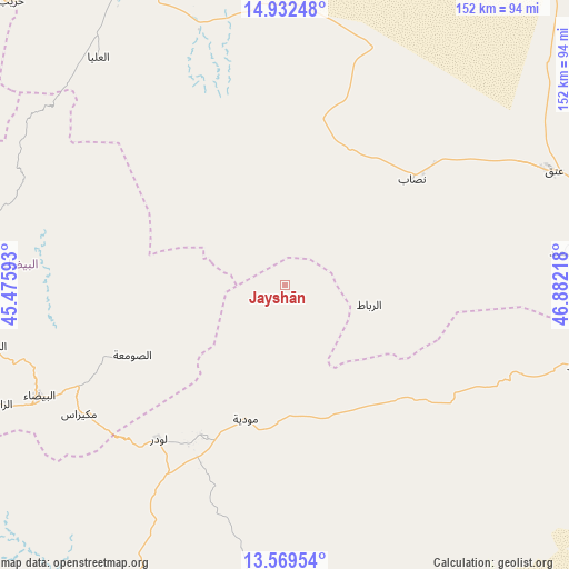
Jayshān GPS coordinates[2]
14° 15' 7.344" North, 46° 10' 44.58" East
| Map corner | latitude | longitude |
|---|---|---|
| Upper-left | 14.93248°, | 45.47593° |
| Center: | 14.25204°, | 46.17905° |
| Lower-right: | 13.56954°, | 46.88218° |
| Map W x H: | 151.5×151.5 km | = 94.1×94.1mi |
| max Lat: | 17.76999° ⇑68.5% North |
| Jayshān: | 14.25204° |
| min Lat: | ⇓31.5% South 12.18576° |
| min Long | Jayshān | max Long |
| 42.67107° | 46.17905° | 54.01895° |
| W 80.2%⇐ | ⇒19.8% E |
Elevation
Elevation of Jayshān is 1562 m = 5125 ft, and this is 257.2 m = 844 ft above average elevation for this country.
| Max E: |
2791 m = 9157 ft | 40.6% |
| Jayshān | 1562 m 5125 ft | |
| Avg. | 1304.8 m = 4281 ft | |
Min E: |
4 m = 13 ft | 59.4% |
See also: Yemen elevation on elevation.city.
Geographical zone
Jayshān is located in North Torrid zone (between Equator and Tropic of Cancer). Distance of this Northern Tropic circle is 1021.2 km =634.5 mi to North.| Distance of | km | miles | from Jayshān |
|---|---|---|---|
| North Pole | 8422.4 | 5233.4 | to North |
| Arctic Circle | 5816.5 | 3614.2 | to North |
| Tropic Cancer | 1021.2 | 634.5 | to North |
| Equator | 1584.7 | 984.7 | to South |


Nearby cities:
15 places around Jayshān: (largest is in red/bold)
• AL-khashā Lower
60.4 km =37.5 mi,  79°
79°
• AL-khashā upper
58.4 km =36.3 mi, 80°
• Al Wuday‘
56.1 km =34.9 mi,  198°
198°
• Al ‘Āqir
45.4 km =28.2 mi,  320°
320°
• Aş Şawma‘ah
44.8 km =27.8 mi,  245°
245°
• Jawf al Maqbābah
59.2 km =36.8 mi,  218°
218°
• Khawrah
20.2 km =12.6 mi,  352°
352°
• Khimār
60.8 km =37.8 mi, 82°
• Lawdar
53 km =32.9 mi, 219°
• Marbāţ
23.1 km =14.4 mi,  102°
102°
• Maswarah
49.8 km =30.9 mi,  281°
281°
• Mukayrās
64.6 km =40.1 mi,  238°
238°
• Mūdīyah
37.5 km =23.3 mi, 196°
• Nişāb
44.2 km =27.5 mi,  50°
50°
• Salābah
59.2 km =36.8 mi, 83°
Sources, notices
• [Note1] Compared only with cities in Yemen existing in our database
• [Src1] Map data: © OpenStreetMap contributors (CC-BY-SA)
• [Src2] Other city data from geonames.org with taken over terms of usage.
• [Src3] Geographical zone / Annual Mean Temperature by Robert A. Rohde @ Wikipedia
