Ḩammām ‘Alī geodata
Ḩammām ‘Alī (Dhamār) is a seat of a second-order administrative division; located in Yemen in Asia/Aden (GMT+3) time zone. In our database, there are 51 cities with bigger population. Compared to other cities in Yemen, 55.8% of cities are located further ↑North; 58.4% of cities are located further →East and 61.7% of cities have lower elevation than Ḩammām ‘Alī. Note1


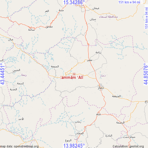
Ḩammām ‘Alī GPS coordinates[2]
14° 39' 49.356" North, 44° 8' 51.468" East
| Map corner | latitude | longitude |
|---|---|---|
| Upper-left | 15.34286°, | 43.44451° |
| Center: | 14.66371°, | 44.14763° |
| Lower-right: | 13.98245°, | 44.85076° |
| Map W x H: | 151.3×151.3 km | = 94×94mi |
| max Lat: | 17.76999° ⇑55.8% North |
| Ḩammām ‘Alī: | 14.66371° |
| min Lat: | ⇓44.2% South 12.18576° |
| min Long | Ḩammām ‘Al | max Long |
| 42.67107° | 44.14763° | 54.01895° |
| W 41.6%⇐ | ⇒58.4% E |
Elevation
Elevation of Ḩammām ‘Alī is 1635 m = 5364 ft, and this is 330.2 m = 1083 ft above average elevation for this country.
| Max E: |
2791 m = 9157 ft | 38.3% |
| Ḩammām ‘Alī | 1635 m 5364 ft | |
| Avg. | 1304.8 m = 4281 ft | |
Min E: |
4 m = 13 ft | 61.7% |
See also: Yemen elevation on elevation.city.
Geographical zone
Ḩammām ‘Alī is located in North Torrid zone (between Equator and Tropic of Cancer). Distance of this Northern Tropic circle is 975.5 km =606.1 mi to North.| Distance of | km | miles | from Ḩammām ‘Alī |
|---|---|---|---|
| North Pole | 8376.6 | 5205 | to North |
| Arctic Circle | 5770.7 | 3585.7 | to North |
| Tropic Cancer | 975.5 | 606.1 | to North |
| Equator | 1630.5 | 1013.1 | to South |


Nearby cities:
15 places around Ḩammām ‘Alī: (largest is in red/bold)
• Ad Dann
47 km =29.2 mi,  222°
222°
• Al Jum‘ah
21.3 km =13.2 mi,  292°
292°
• Al Mayfa’ah
48.5 km =30.1 mi,  117°
117°
• Al-Medy Village, قرية المدي
48.1 km =29.9 mi,  232°
232°
• Aḑ Ḑil‘
35.4 km =22 mi,  271°
271°
• Dhamār
30.8 km =19.1 mi, 115°
• Mafḩaq
55.3 km =34.4 mi,  331°
331°
• Ma‘bar
21.4 km =13.3 mi,  47°
47°
• Riḩāb
48.7 km =30.3 mi,  174°
174°
• Sūq ar Rubū‘
22.1 km =13.7 mi, 220°
• Wa‘lān
47.3 km =29.4 mi,  17°
17°
• Yarīm
47.6 km =29.6 mi,  148°
148°
• Zarājah
33.6 km =20.9 mi, 47°
• Ḑawrān ad Daydah
10.5 km =6.5 mi,  37°
37°
• Ḑubāh
19.3 km =12 mi,  185°
185°
Sources, notices
• [Note1] Compared only with cities in Yemen existing in our database
• [Src1] Map data: © OpenStreetMap contributors (CC-BY-SA)
• [Src2] Other city data from geonames.org with taken over terms of usage.
• [Src3] Geographical zone / Annual Mean Temperature by Robert A. Rohde @ Wikipedia
