Ḩadādah geodata
Ḩadādah (Laḩij) is a seat of a second-order administrative division; located in Yemen in Asia/Aden (GMT+3) time zone. In our database, there are 51 cities with bigger population. Compared to other cities in Yemen, 94.8% of cities are located further ↑North; 53.9% of cities are located further →East and 72.7% of cities have higher elevation than Ḩadādah. Note1


Ḩadādah GPS coordinates[2]
13° 10' 31.26" North, 44° 16' 28.596" East
| Map corner | latitude | longitude |
|---|---|---|
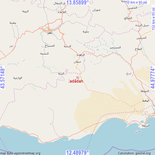
| Upper-left | 13.85899°, | 43.57149° |
| Center: | 13.17535°, | 44.27461° |
| Lower-right: | 12.48979°, | 44.97774° |
| Map W x H: | 152.2×152.2 km | = 94.6×94.6mi |
| max Lat: | 17.76999° ⇑94.8% North |
| Ḩadādah: | 13.17535° |
| min Lat: | ⇓5.2% South 12.18576° |
| min Long | Ḩadādah | max Long |
| 42.67107° | 44.27461° | 54.01895° |
| W 46.1%⇐ | ⇒53.9% E |
Elevation
Elevation of Ḩadādah is 714 m = 2343 ft, and this is 590.8 m = 1938 ft below average elevation for this country.
| Max E: |
2791 m = 9157 ft | 72.7% |
| Avg. | 1304.8 m = 4281 ft | |
| Ḩadādah | 714 m = 2343 ft | |
Min E: |
4 m = 13 ft | 27.3% |
See also: Yemen elevation on elevation.city.
Geographical zone
Ḩadādah is located in North Torrid zone (between Equator and Tropic of Cancer). Distance of this Northern Tropic circle is 1141 km =709 mi to North.| Distance of | km | miles | from Ḩadādah |
|---|---|---|---|
| North Pole | 8542.1 | 5307.8 | to North |
| Arctic Circle | 5936.2 | 3688.6 | to North |
| Tropic Cancer | 1141 | 709 | to North |
| Equator | 1465 | 910.3 | to South |


Nearby cities:
15 places around Ḩadādah: (largest is in red/bold)
• Ad Dimnah
32.6 km =20.3 mi,  342°
342°
• Al Masālīyah
49.8 km =30.9 mi,  322°
322°
• Al Misrākh
42 km =26.1 mi, 319°
• Al Musaymīr
47.4 km =29.5 mi,  50°
50°
• Al Nashmah
40.9 km =25.4 mi,  305°
305°
• Al ‘Ayn
26.2 km =16.3 mi, 311°
• Ash Shaţţ
40.6 km =25.2 mi,  219°
219°
• At Turbah
16.8 km =10.4 mi,  284°
284°
• Aş Şalw
18.2 km =11.3 mi, 339°
• Kirsh
31.4 km =19.5 mi, 47°
• Māwiyah
46 km =28.6 mi,  9°
9°
• Yufrus
47.2 km =29.3 mi, 311°
• Ţawr al Bāḩah
2.8 km =1.7 mi,  75°
75°
• Ḩawrah
24.6 km =15.3 mi,  325°
325°
• Ḩayfān
15.8 km =9.8 mi,  2°
2°
Sources, notices
• [Note1] Compared only with cities in Yemen existing in our database
• [Src1] Map data: © OpenStreetMap contributors (CC-BY-SA)
• [Src2] Other city data from geonames.org with taken over terms of usage.
• [Src3] Geographical zone / Annual Mean Temperature by Robert A. Rohde @ Wikipedia
